Disclosure : This site contains affiliate links to products. We may receive a commission for purchases made through these links.
Salford Docks 1905

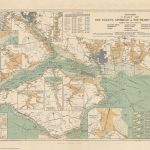
Salford Docks in 1905 in a fascinating series of reproductions of old Ordnance Survey plans in the Alan Godfrey Editions, ideal for anyone interested in the history of their neighbourhood or family. Three versions have been published for this area, showing how it changed across the years. The maps cover the now greatly changed with Salford Quays, together with a part of Ordsall. Features include Ordsall Hall, Salford Lads Club, Ordsall Park, St Ignatius church, St Clement`s church, Cross Lanes station and cattle station, Regent Theatre, Salford Workhouse, Woodside Brewery, Tatton Mills, Stowell Memorial Church, Salford Borough Cemetery, part of Pomona Docks, Number 6, 7, 8 and 9 Docks, Salford end of Manchester Ship Canal, L&Y railway with the little used New Barns station, Mode Wheel Locks, Mode Wheel engine shed, Manchester Ship Canal Railway with extensive lines around the docks, Trafford Wharf, depots and warehouses, Hovis Mills and grain elevator, Foreign Animals Wharf, timber yards, etc. The 1932 version is partly coloured, with the partial colour-printing introduced by the OS at that time.About the Alan Godfrey Editions of the 25″ OS Series:Selected towns in Great Britain and Ireland are covered by maps showing the extent of urban development in the last decades of the 19th and early 20th century. The plans have been taken from the Ordnance Survey mapping and reprinted at about 15 inches to one mile (1:4,340). On the reverse most maps have historical notes and many also include extracts from contemporary directories. Most maps cover about one mile (1.6kms) north/south, one and a half miles (2.4kms) across; adjoining sheets can be combined to provide wider coverage.FOR MORE INFORMATION AND A COMPLETE LIST OF ALL AVAILABLE TITLES PLEASE CLICK ON THE SERIES LINK.

Related Products:
 Salford Docks 1916
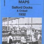 Salford Docks & Ordsall 1932 – 104.09c
 Manchester North West and Central Salford 1915
Old Trafford 1905
Manchester North West and Central Salford 1915
Old Trafford 1905
 Bootle Docks & Seaforth 1907 – 99.13
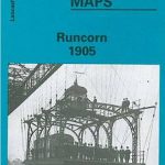 Runcorn 1905 – 115.13b
Openshaw 1905
Huddersfield Central 1905
Runcorn 1905 – 115.13b
Openshaw 1905
Huddersfield Central 1905
 Old Trafford 1915
 Manchester (NW) & Central Salford 1931 – 104.06c
West India Docks & Greenwich Marshes 1894 – 79.2
Manchester (NW) & Central Salford 1931 – 104.06c
West India Docks & Greenwich Marshes 1894 – 79.2
 West India Docks 1867 – 79.1
 Goole 1905
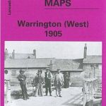 Warrington West 1905
 Garston 1905 – 113.12b
Ivybridge 1905
Garston 1905 – 113.12b
Ivybridge 1905
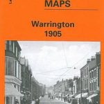 Warrington 1905
 Heckmondwike 1905
Abram 1905
Horbury 1905
Ossett Central 1905
Heckmondwike 1905
Abram 1905
Horbury 1905
Ossett Central 1905
 Manchester & Salford – Oldham, Rochdale & Stockport OS Explorer Map 277 (paper)
 Birmingham Central 1913
Birmingham Central 1902-1911
Birmingham Central 1913
Birmingham Central 1902-1911
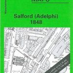 Salford Adelphi 1848
 Manchester & Salford – Oldham, Rochdale & Stockport OS Explorer Active Map 277 (waterproof)
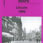 City of Lincoln 1905 – 70.07a
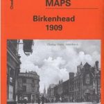 Birkenhead 1909 – 13.03b
 Coventry 1905 – 21.12b
 Oakenshaw, Low Moor and Wyke 1905
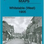 Whitstable West 1905
Flixton 1904
Whitstable West 1905
Flixton 1904
 Staincliffe and Batley Carr 1892
 Ramsgate 1905
Looe 1905
Stalybridge and Ashton 1918
Ramsgate 1905
Looe 1905
Stalybridge and Ashton 1918
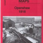 Openshaw 1916
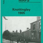 Knottingley 1905
Kidderminster 1921
Halifax South West and Sowerby Bridge 1892
Knottingley 1905
Kidderminster 1921
Halifax South West and Sowerby Bridge 1892