Disclosure : This site contains affiliate links to products. We may receive a commission for purchases made through these links.
Saint-Martin / Sint Maarten – St.Barthรฉlemy IGN 4606GT
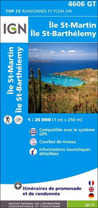
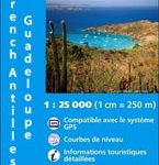
The islands of St. Martin and St. Barthรฉlemy on a detailed, GPS compatible map at 1:25,000 published by the Institut Gรฉographique National in Paris as part of their series covering the islands belonging to the Guadeloupe administrative department.Contour interval varies according to the terrain (5m or 10m), with bold relief shading and plenty of information on the type of vegetation: woods and forests, brushwood, gardens and orchards, banana and sugar cane plantations, mangrove swamps. In addition to the usual information found on topographic survey maps at this scale, on the French side of Saint-Martin overprint highlights local hiking routes, various tourist facilities and places of interest. Tourist overprint is also provided for St. Barthรฉlemy, but not on Sint Maarten, the Dutch side of the St. Martin Islands. The map has a 1km UTM grid, plus a latitude/longitude grid at 5’ intervals. Map legend includes English.To see other titles in this series please click on the series link.

Related Products:
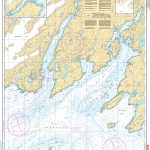
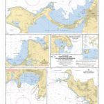 SHOM Chart 7472 – Ports et mouillages de Saint-Martin (Sint Maarten) et de Saint-Barthรฉlemy
 Saint Martin / Sint Maarten
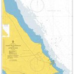
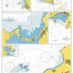 Admiralty Chart 2079 – Ports and Anchorages in Anguilla-Sint Maarten (Saint Martin) and Saint Barthelemy
 Ganges – Saint-Martin-de-Londres – Pic Saint-Loup IGN 2742ET
 Guadeloupe – St. Martin / Sint Maarten – St. Barthelemy IGN 84971
 Valle Centrale – Saint-Barthรฉlemy – Saint-Marcel – Val Clavalite L`Escursionista Editore 13
 Saint-Martin-de-Crau IGN 3043OT
 Tardets-Sorholus – Saint-Martin IGN 1446ET
 Noiretable – Saint-Martin-la-Sauvete IGN 2731SB
 Valpelline – Saint-Barthรฉlemy L`Escursionista Editore 6
 Guadeloupe – St. Martin – St. Barthรฉlemy Michelin Zoom 137
 Guadeloupe/French Antilles: 25K Topographic Survey Maps
 Saint-Chely-d`Apcher – Saint-Amams IGN 2637SB
 Saint-Benin-d`Azy – Saint-Saulge IGN 25K Sรฉrie Bleue Map 2624SB
 Saint-Jean-de-Maurienne – Saint-Francois-Longchamp – Valmorel IGN 3433ET
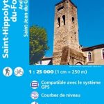 Saint-Hippolyte-du-Fort – Anduze – Saint-Jean-du-Gard IGN 2741ET
 Valpelline – Saint Barthรฉlemy – Aosta Valle Centrale Fraternali Editore 31
 Saint-Martin-de-Crau – les Baux-de-Provence – les Alpilles IGN 3043OT
 SHOM Chart 7471L – D’Anguilla ร Saint-Barthรฉlemy – Leisure A4 size
 Guadeloupe – Saint-Franรงois – Marie-Galante – La Dรฉsirade IGN 4604GT
 St-Martin-d`Auxigny – Foรฉcy IGN 25K Sรฉrie Bleue Map 2323SB
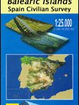 Colonia de Saint Pere 25K Mallorca CNIG Topographic Survey Map No. 672-III
 SHOM Chart 7626 – Saint Christopher (Saint Kitts), Sint Eustatius et Saba
 Pierre-de-Bresse – St-Martin-en-Bresse IGN 3125SB
 Martinique & Guadeloupe ITMB
 Fodor`s In Focus St. Maarten/St. Martin, St. Barth & Anguilla
 Saint-Gervais-d`Auvergne IGN Map 2430SB
 Saint-Eloy-les-Mines IGN 2429SB
 Rochefort – Saint-Porchaire IGN 1430SB
Rochechouart – Saint-Junien IGN 1931SB
Rochefort – Saint-Porchaire IGN 1430SB
Rochechouart – Saint-Junien IGN 1931SB
 la Souterraine – Saint-Vaury IGN 2129SB
Nantes – Saint-Herblain IGN 1223SB
la Souterraine – Saint-Vaury IGN 2129SB
Nantes – Saint-Herblain IGN 1223SB
 Nuits-Saint-Georges IGN 3023OT
 Neufchรขteau – Saint-Blin IGN 3217SB
 Saint-Saens – Cleres IGN 2010SB
 Ile d`Yeu – Saint-Gilles-Croix-de-Vie IGN 1126OT
 Saint Malo – Cรดte d`Emeraude – Le Mont-Saint-Michel IGN 75037
 Gavarnie – Luz-Saint-Sauveur – PN des Pyrรฉnรฉes IGN 1748OT
 Mauleon-Licharre – Saint-Palais IGN 1445SB
Caussade – Saint-Antonin-Noble-Val IGN 2140SB
Mauleon-Licharre – Saint-Palais IGN 1445SB
Caussade – Saint-Antonin-Noble-Val IGN 2140SB