Disclosure : This site contains affiliate links to products. We may receive a commission for purchases made through these links.
Saint Martin / Sint Maarten
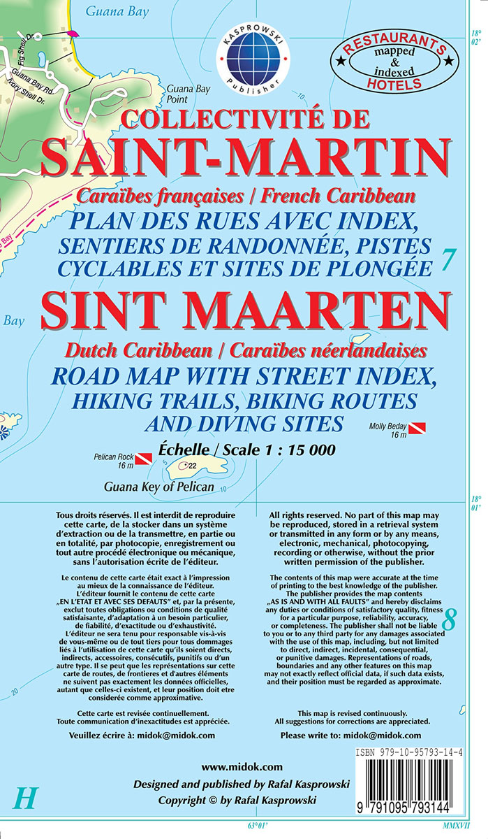
Saint-Martin/Sint Maarten at 1:15,000 on an indexed map from the Caribbean-based cartographer Michal Kasprowski highlighting beaches and water sports sites, with street plans of Marigot and Philipsburg. Main roads are highlighted and named and the map also shows names of many smaller local roads and streets in build-up areas. Also marked are cart tracks and footpaths. Symbols show beaches and water sport sites, lighthouses, harbours and marinas, etc. All information covers both the French and the Dutch side of the island. The map has contours at 20m intervals, with a few spot heights, plus colouring to show woodlands. Along the coast reefs and nature reserves are marked. Latitude and longitude lines are marked at 1’ intervals. Street plans at 1:5,000 show in greater detail Marigot and Philipsburg. Map legend is in English and French.

Related Products:
 St. Martin & Anguilla ITMB
 Saint-Martin / Sint Maarten – St.Barthรฉlemy IGN 4606GT
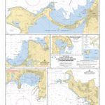 SHOM Chart 7472 – Ports et mouillages de Saint-Martin (Sint Maarten) et de Saint-Barthรฉlemy
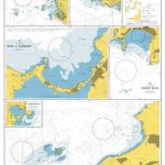 Admiralty Chart 2079 – Ports and Anchorages in Anguilla-Sint Maarten (Saint Martin) and Saint Barthelemy
 Guadeloupe – St. Martin / Sint Maarten – St. Barthelemy IGN 84971
 Dominica & Saint Lucia ITMB
 Fodor`s In Focus St. Maarten/St. Martin, St. Barth & Anguilla
 St-Barthรฉlemy
 Ganges – Saint-Martin-de-Londres – Pic Saint-Loup IGN 2742ET
 Anguilla
 St. Kitts and Nevis
 Saint-Martin-de-Crau IGN 3043OT
 Tardets-Sorholus – Saint-Martin IGN 1446ET
 Noiretable – Saint-Martin-la-Sauvete IGN 2731SB
 Saint Lucia
 Aruba
Aruba
 Saba (Dutch Antilles)
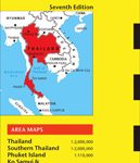 Thailand Periplus Travel Map
 St Eustatius / Statia
 Sint Maarten Flag – 1/2 yard – Printed
 Saint-Etienne Blay-Foldex Street Plan
 SHOM Chart 7626 – Saint Christopher (Saint Kitts), Sint Eustatius et Saba
 Saint-Malo – Dinard Blay-Foldex Street Plan
 Curaรงao
 Valle Centrale – Saint-Barthรฉlemy – Saint-Marcel – Val Clavalite L`Escursionista Editore 13
 A24 Anguilla, St Martin and St Barthelemy
 Ecuador Borch
 Santorini Reise Know-How
 Bonaire
 Martinique & Guadeloupe ITMB
 Cuba ITMB
 Dominica
 Cape Verde AB Kartenverlag Road and Leisure Map
 Bali & Lombok ITMB
 Virgin Islands (US and British) ITMB
 Saint John – Fredericton NB
 Sri Lanka Nelles
 Saint-Benin-d`Azy – Saint-Saulge IGN 25K Sรฉrie Bleue Map 2624SB
 Saint-Jean-de-Maurienne – Saint-Francois-Longchamp – Valmorel IGN 3433ET
 Saint-Hippolyte-du-Fort – Anduze – Saint-Jean-du-Gard IGN 2741ET