Disclosure : This site contains affiliate links to products. We may receive a commission for purchases made through these links.
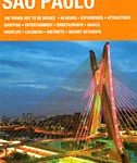
Sรฃo Paulo de Dios CityMap
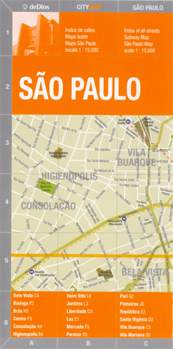
Sรฃo Paulo CityMap in a series of light, laminated and waterproof concertina street plans of Latin American capitals and main cities from the Buenos Aires ‘“based de Dios, designed to present each city’s most visited areas. The plans are indexed and include diagrams of metro networks.The plan of Sรฃo Paulo is at 1:15,000 presents the central part of the city in two sections, providing overall coverage from the Luz district and the Museu de Arte Sacra to Paraiso and Itaim Bibi. Main traffic arteries are highlighted and metro stations are clearly marked. On the reverse is a street index plus a map of the metro network.PLEASE NOTE: de Dios also publish a more tourist-oriented Map/Guide of Sรฃo Paulo, covering roughly the same area and highlighting 100 attractions, all with brief descriptions, plus providing extensive other information, tourist tips, etc.

Related Products:
 Sao Paulo de Dios Map-Guide
 Rio de Janeiro de Dios CityMap
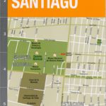 Santiago de Chile de Dios CityMap
 Sao Paulo & Brazil South Coast ITMB
 Santiago de Dios Map-Guide
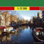
 Amsterdam Citymap & More
 Delft Citymap & More
 Bruges Citymap & More
 Leuven Citymap & More
Dordrecht Citymap & More
Netherlands/Belgium: Falk Citymap & More Pocket Street Plans
Leuven Citymap & More
Dordrecht Citymap & More
Netherlands/Belgium: Falk Citymap & More Pocket Street Plans
 Rotterdam Falkplan Citymap & More
Maastricht – Valkenburg Citymap & More
Rotterdam Falkplan Citymap & More
Maastricht – Valkenburg Citymap & More
 Haarlem – Zandvoort aan Zee Citymap & More
 Buenos Aires de Dios Map-Guide
 Rio de Janeiro de Dios Map-Guide
Buenos Aires Street de Dios Street Plan
Rio de Janeiro de Dios Map-Guide
Buenos Aires Street de Dios Street Plan
 Antwerp Falkplan Citymap & More
 Buenos Aires Milongas de Dios Street Plan
 Peru de Dios Map-Guide
 Amsterdam F&B
Palermo TCI Street Plan
Amsterdam F&B
Palermo TCI Street Plan
 Sรฃo Nicolau AB Kartenverlag Hiking Map
 Sรฃo Vicente – Mindelo AB Kartenverlag Hiking Map
 South America de Dios Map-Guide
 Montevideo de Dios Map-Guide
 Argentina: de Dios Tourist Maps of Popular Regions
 Sao Paulo Footprint Handbook
North Argentina de Dios Regional Map
Sao Paulo Footprint Handbook
North Argentina de Dios Regional Map
 Brazil Michelin
 Paris Michelin Citymap
 Iguazu Falls de Dios Regional Map
 Barcelona Michelin Citymap
 Brasil`s Southern Beaches de Dios Map
El Chaten – El Calafate de Dios Regional Map
Brasil`s Southern Beaches de Dios Map
El Chaten – El Calafate de Dios Regional Map
 Bahia de Dios Map-Guide
 Bolivia de Dios Map-Guide
 Peninsula Valdes de Dios Regional Map
 Brazil de Dios Map-Guide