Disclosure : This site contains affiliate links to products. We may receive a commission for purchases made through these links.
Categories
-
Best Sellers
-
Enfield (South) 1895 – 7.07a
Enfield South in 1895 in a fascinating series of reproductions of old Ordnance Survey plans in the Alan Godfrey Editions, ideal for anyone interested in the Read More » -

Tocksfors – Arjang – Nysater Norstedts Outdoor 16
This map of Tocksfors Arjang Nysater in 1:50,000 is part of a series of topographic maps from Norstedts Kartforlaget which includes 28 outdoor maps covering the Read More » -
Shire Library
-
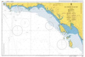
Admiralty Chart 3966 – Ko Chuang to Ko Kut
Admiralty standard nautical charts comply with Safety of Life at Sea (SOLAS) regulations and are ideal for professional, commercial and recreational use. Charts within the series Read More » -

Britain`s Best Dog-Friendly Places to Stay
-
Tashkent
Tashkent region at 1:500,000 in a series of detailed, contoured maps of the mountains of Central Asia derived from the Soviet era topographic survey but with Read More » -

Swietokrzyskie Cycling Map
A series of maps, following the trail of the most beautiful cycling routes across Poland at 1:100,000 scale, include: – the exact course of the trail Read More » -

Ocean Liners: Speed and Style
The great age of ocean travel has long since passed, but ocean liners remain one of the most powerful and admired symbols of modernity. No form Read More » -
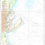
127 Kattegat – Arhus Havn
Official charts for the coast of Denmark produced by the Danish Hydrographic Office. The charts are ordered upon customer demand, therefore please contact us if you Read More » -

NOAA Chart 11547 – Morehead City Harbor
NOAA maintains the nautical charts and publications for U.S. coasts and the Great Lakes. Over a thousand charts cover 95,000 miles of shoreline and 3.4 million Read More »
-


