Disclosure : This site contains affiliate links to products. We may receive a commission for purchases made through these links.
Rwenzori Mountains

Rwenzori Mountains and the National Park on the border between Uganda and the Congo Democratic Republic on a map presenting the area at three scales, plus extensive text providing information on various aspects of the region including walking and climbing routes.On one side are three maps: central Rwenzori is covered at 1:50,000 with contour lines at 100m intervals and a more detailed map at 1:20,000 presents the area around the main peaks with contour interval of 50m. Both maps indicate recent and present day glaciated areas, major cliffs, marshland and different types of vegetation. The maps show established paths and possible routes, huts and rock shelters, etc.The third map at 1:400,000 presents the area around the two national parks, with coverage extending to the Kasese and Fort Portal on the Ugandan side and Semliki River in Congo. The map shows towns and villages, the road network, airfields, etc. A small inset places the whole region in a wider context within the two countriesThe reverse side is covered by text, illustrated with colour photos, on various aspects of the area including its history, fauna and flora, climate, illness and accidents, cooking and mountain food, equipment, etc. Notes provide information and routes descriptions for approaches from Congo (one 4-day circuit) or from Uganda (several walking circuits and routes, plus five climbing routes). Also provided is a list of useful contact details.

Related Products:
 Africa`s Highest Peaks – Kilimanjaro – Mount Kenya – Rwenzori terraQuest Trekking Map
 Walking and Trekking in Zagori: Walking routes in Greece`s wild and beautiful northern Pindos mountains
 France: Kummerly + Frey Recreational Maps of the Vosges Mountains and Alsace
 Carpathian Mountains (AT/CZ/SK/PL/UA/HU/RO) Huber Map
 Bucegi Mountains
 Apuseni Mountains
 Tatras Mountains – Poland & Slovakia
 Walking Ben Lawers, Rannoch and Atholl: Mountains and Glens of Highland Perthshire
 Tatra Mountains PL/SK
 Busen Region – South Georgia BAS
 Western Ore Mountains – Aue – Eibenstock – Kurort Oberwiesenthal Kompass 806
 Parang Mountains Dimap Hiking Map
 Tarcau Mountains and Ghimes Dimap Hiking Map
 Ireland: EastWest Mapping Hiking Maps of the Wicklow Mountains
 Mecsek – Villรกny Mountains Cartographia Tourist Map 15
 Karavanke Mountains – Kep to Kosuta Kartografija WATERPROOF Hiking Map
 Fagaras Mountains Dimap Hiking Map
Gurghiu Mountains Northern and Central Dimap Hiking Map
Fagaras Mountains Dimap Hiking Map
Gurghiu Mountains Northern and Central Dimap Hiking Map
 Algeria: Ahaggar (Hoggar) Mountains Reise-Know-How Map
 Spanish Trails – A Guide to Walking the Spanish Mountains – The Mountains of Madrid
Gilau Mountains Dimap Hiking Map
Spanish Trails – A Guide to Walking the Spanish Mountains – The Mountains of Madrid
Gilau Mountains Dimap Hiking Map
 Rocky Mountains Canada and US ITMB
 5 – Mala (Small) Fatra Mountains
 Samokov – Borovets with the Rila Mountains
 Bihor Mountains Dimap Hiking Map
 Retezat Mountains Dimap Hiking Map
 South Africa: 50K Hiking Maps of the Drakensberg Mountains
 Mountains around Vienna Freytag & Berndt Hiking Atlas
 4000m: Climbing the Highest Mountains of the Alps
 When Men & Mountains Meet: Like the Desire for Drink or Drugs, the Craving for Mountains is Not Easily Overcome
 Dublin and North Wicklow Mountains (30K)
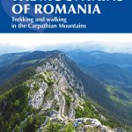 The Mountains of Romania: Trekking in the Carpathian Mountains
 Northern Ireland – A Walking Guide
 The High Atlas: Treks and Climbs on Morocco`s Biggest and Best Mountains
 Cajรณn del Maipo – Volcรกn San Josรฉ
 Dublin Mountains (25K)
Caliman Mountains Dimap Hiking Map
Rarau-Giumalau Mountains and Bucovina Monasteries Dimap Hiking Map
Dublin Mountains (25K)
Caliman Mountains Dimap Hiking Map
Rarau-Giumalau Mountains and Bucovina Monasteries Dimap Hiking Map
 Mallorca North Walking & Cycling Map & Guide Editorial Alpina
 Cindrel Mountains