Disclosure : This site contains affiliate links to products. We may receive a commission for purchases made through these links.
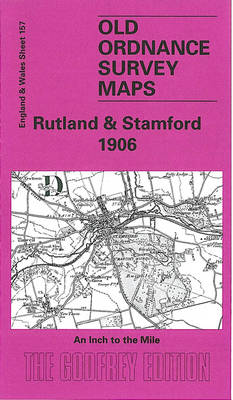
Rutland & Stamford 1906 – 157
Related Products:
 Rutland Water – Stamford & Oakham OS Explorer Map 234 (paper)
 Rutland Water – Stamford & Oakham OS Explorer Active Map 234 (waterproof)
 Stamford Hill 1937 – 21.4
 Rutland
 Domesday Book Rutland (29)
 In the Footsteps of Stamford Raffles
 Leicestershire & Rutland – Drive & Stroll
 Leicestershire and Rutland Philip`s Street Atlas
 The Hills of Leicestershire & Rutland: A Guide to Walking
 Green Mountain National Forest – Moosalamoo NRA – Rutland VT
 Market Weighton, Goole & Stamford Bridge OS Landranger Map 106 (paper)
 Kettering, Corby, Market Harborough & Stamford OS Landranger Map 141 (paper)
 Market Weighton, Goole & Stamford Bridge OS Landranger Active Map 106 (waterproof)
 Kettering, Corby, Market Harborough & Stamford OS Landranger Active Map 141 (waterproof)
 Haverfordwest 1906 – 27.08
 Garforth 1906 – 219.06
 Tadcaster 1906 – 190.09
 Skegness 1906 – 84.11
 NE Lincolnshire 1906 – 90
 Huyton 1906 – 107.10
 Golborne 1906 – 102.09
 Camborne 1906 – 63.09
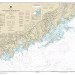 NOAA Chart 12368 – North Shore of Long Island Sound’”Sherwood Point to Stamford Harbor
 Thatto Heath 1906 – 107.08
 Milford Haven 1906 – 33.14
 Aberford & Parlington 1906 – 204.15
 Nottingham & District 1906 – 126
 North Nottinghamshire 1906 – 101
 South Holland 1906 – 144
 The White Peak 1906 – 111
 The High Peak 1906 – 99
 NW Norfolk 1897-1906 – 130
 Leicester & District 1906 – 156
 Central Northants 1906 – 185
 Peterborough & District 1906 – 158
 South Kesteven 1906 – 143
 Truro (North) 1906 – 57.12
 Truro (South) 1906 – 57.16
 Childwall & Court Hey 1906 – 107.13
 Roby & Dovecot 1906 – 107.09


