Disclosure : This site contains affiliate links to products. We may receive a commission for purchases made through these links.
Russia: Roskartografia Regional Road Atlases
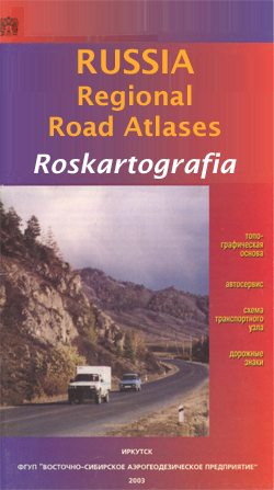
Administrative provinces of the Russian Federation in a series of detailed atlases from Roskartografia with road information shown on a topographic base. All place names are in the Cyrillic alphabet and the text, including map legends, is in Russian only. Most atlases in this series were published in the early 2000s, and only a small selection is still available.Road network includes minor local roads, service stations, and driving distances. Colour coding distinguishes between federal roads and those which are the responsibility of local government. In many areas tracks and footpaths are included. The atlases also show railway lines, as well as inland waterways with locations of locks and the direction of the current. Cities and towns are marked according to the size of their population. Symbols indicate natural landmarks, post offices, hospitals and other facilities, museums, monuments, etc. Topography is shown by contours at 100m intervals and spot heights. The maps have no geographical coordinated. Each atlas has an index and includes an administrative map of the region and a key to Russian road signs. Most titles also include a basic street plan of the provincial capital. In some atlases coverage is provided only for the areas with roads and not for the whole province – please see individual descriptions or images of the area coverage supplied with each title. IMPORTANT – PLEASE NOTE BEFORE ORDERING: Supplies are very erratic and no delivery date can be guaranteed for titles currently not in stock. Also, we occasionally receive copies with different covers or in different sizes to those indicated on our website, but the cartography and basic information remains as described above.

Related Products:
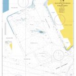
 Yevreyska Autonomous Oblast Road Atlas
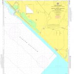
Primorski Krai Road Atlas
Yevreyska Autonomous Oblast Road Atlas
Primorski Krai Road Atlas
 Great Britain: A-Z Regional Road Maps and Atlases
 Russia: Merkury 700K Regional Road Maps of Western Russia
 Canada: MapArt / Canadian Cartographics Corporation Provincial and Regional Road Maps and Atlases
 Great Britain: Philip`s Navigator Regional Road Atlases
 Latvia: Jana Seta 100K Adventure Road Atlases
 Benelux: Michelin Regional Road Maps and Atlases
 USA: DeLorme State Road Atlases
 Australia: Hema Road Atlases and Touring/Camping Guides
Great Britain: Philip`s Road Atlases
Australia: Hema Road Atlases and Touring/Camping Guides
Great Britain: Philip`s Road Atlases
 Australia: UBD Gregory`s Road Atlases
 India: Nelles Regional Road Maps
 Germany: ADAC Regional Street Atlases
 USA: Rand McNally Road Atlases 2018
 London: A-Z Street Atlases and Maps
 East Anglia A-Z Regional Road Atlas
 Spain: Mairdumont 300K Regional Road Maps
USA: Benchmark Road and Recreational Atlases of Western USA
Spain: Mairdumont 300K Regional Road Maps
USA: Benchmark Road and Recreational Atlases of Western USA
 Southern England A-Z Regional Road Atlas
 USA: Borch Regional Road Maps
 Sweden: Norstedts Regional Road Maps
 Canada: Reise Know-How Regional Road Maps
Canada: MapArt/Canadian Cartographics Corporation Cities and Regions Street Maps and Road Atlases
Canada: Reise Know-How Regional Road Maps
Canada: MapArt/Canadian Cartographics Corporation Cities and Regions Street Maps and Road Atlases
 Wales A-Z Regional Road Atlas
 Argentina: Firestone Regional Road Maps
 Great Britain: Philip`s City Street Atlases
 Russia: Topographic Maps of Elbrus and Western Caucasus
 Great Britain: A-Z Towns and Cities Street Atlases
 Kiev Administrative Region
Zhytomyr Administrative Region
Ternopil Administrative Region
Khmelnytskyi Administrative Region
Lviv Administrative Region
Rivne Administrative Region
Vinnytsia Administrative Region
Chernihiv Administrative Region
Poltava Administrative Region
Kirovohrad Administrative Region
Chernivtsi Administrative Region
Kiev Administrative Region
Zhytomyr Administrative Region
Ternopil Administrative Region
Khmelnytskyi Administrative Region
Lviv Administrative Region
Rivne Administrative Region
Vinnytsia Administrative Region
Chernihiv Administrative Region
Poltava Administrative Region
Kirovohrad Administrative Region
Chernivtsi Administrative Region