Disclosure : This site contains affiliate links to products. We may receive a commission for purchases made through these links.
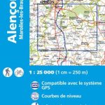
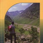
Rum – Eigg – Canna – Muck Harvey Superwalker XT25
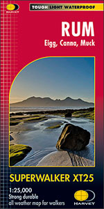
Scottish islands of Rum Canna, Eigg and Muck at 1:25,000 on a light, waterproof and tear-resistant map from Harvey Map Services. Most of Rum is shown on one side, with its westernmost part on the reverse with Cana and Sanday, plus on separate panels Eigg and Muck. Additional information includes contact details for transport to the islands, hostel accommodation, and general notes.Maps in Harvey’s Superwalker series have contours at 15m intervals, with additional graphics for various types of terrain (crags, large boulders, scattered rocks) and colouring for different kinds of land use or vegetation (pastures, bogs, forests or woodland, etc). The maps show local hiking paths, indicating where appropriate long-distance routes, and boundaries of national parks or other protected areas. Scottish titles also indicate Munro, Corbett and Graham hills. Some maps additionally highlight local cycle routes. A range of symbols mark various facilities for walkers including youth or independent hostels, campsites and caravan sites, information points, etc. Each map has a 1-km British or Irish national grid.To see other titles in this series please click on the series link.

Related Products:
 Rum, Eigg, Muck, Canna & Sanday OS Explorer Map 397 (paper)
 Rum, Eigg, Muck, Canna & Sanday OS Explorer Active Map 397 (waterproof)
 Ben Lawers and Schiehallion Harvey Superwalker XT25
 Arrochar Alps Harvey Superwalker XT25
 Torridon Harvey Superwalker XT25
 Ben Alder Harvey Superwalker XT25
 Peak District South Harvey Superwalker XT25
 Trotternish – Skye Harvey Superwalker XT25
 Cairn Gorm & Ben Avon Harvey Superwalker XT25
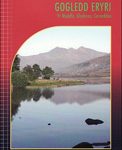 Snowdonia North Harvey Superwalker XT25
 Lake District West Harvey Superwalker XT25
 Yorkshire Dales South East Harvey Superwalker XT25
 Ochil Hills Harvey Superwalker XT25
Yorkshire Dales South West Harvey Superwalker XT25
Ochil Hills Harvey Superwalker XT25
Yorkshire Dales South West Harvey Superwalker XT25
 Peak District North Harvey Superwalker XT25
 Lake District North Harvey Superwalker XT25
Yorkshire Dales North East Harvey Superwalker XT25
Lake District North Harvey Superwalker XT25
Yorkshire Dales North East Harvey Superwalker XT25
 Peak District Central Harvey Superwalker XT25
 Lake District South East Harvey Superwalker XT25
 The Cuillin – Skye Harvey Superwalker XT25
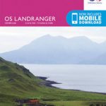 Rum, Eigg, Muck & Canna OS Landranger Map 39 (paper)
Yorkshire Dales North West Harvey Superwalker XT25
Rum, Eigg, Muck & Canna OS Landranger Map 39 (paper)
Yorkshire Dales North West Harvey Superwalker XT25
 Rum, Eigg, Muck & Canna OS Landranger Active Map 39 (waterproof)
 Arran – incl. Arran Coastal Way Harvey Superwalker XT25 Map
 Ben Nevis – Mamores & Grey Corries Harvey Superwalker XT25
An Teallach & Fisherfield Harvey Superwalker
Ben Nevis – Mamores & Grey Corries Harvey Superwalker XT25
An Teallach & Fisherfield Harvey Superwalker
 Ben Venue – Loch Ard Forest & the Trossachs Harvey Superwalker
 Isle of Man Harvey Superwalker XT30
Cadair Idris – Snowdonia / Eryri Harvey Superwalker
Great Britain and Ireland: Harvey Superwalker & Ultramap Maps
Isle of Man Harvey Superwalker XT30
Cadair Idris – Snowdonia / Eryri Harvey Superwalker
Great Britain and Ireland: Harvey Superwalker & Ultramap Maps
 MacGillycuddy`s Reeks Harvey Superwalker XT30
Ben Lawers & Schiehallion Harvey Ultramap XT40
Ben Alder Harvey Ultramap XT40
Snowdonia North Harvey Ultramap XT40
Pentland Hills Harvey Ultramap XT40
MacGillycuddy`s Reeks Harvey Superwalker XT30
Ben Lawers & Schiehallion Harvey Ultramap XT40
Ben Alder Harvey Ultramap XT40
Snowdonia North Harvey Ultramap XT40
Pentland Hills Harvey Ultramap XT40
 Glen Coe – Glen Etive & Black Mount Harvey Ultramap XT40
Torridon Harvey Ultramap XT40
Peak District South Harvey Ultramap XT40
Glen Coe – Glen Etive & Black Mount Harvey Ultramap XT40
Torridon Harvey Ultramap XT40
Peak District South Harvey Ultramap XT40