Disclosure : This site contains affiliate links to products. We may receive a commission for purchases made through these links.
Ripollรจs Editorial Alpina
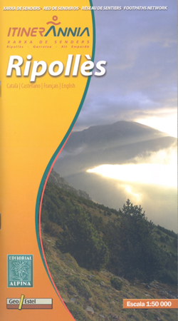
Ripollรจs in an extensive and very popular series of walking maps from Editorial Alpina covering the Pyrenees, Catalonia and other selected hiking areas in Spain, including Picos de Europa, Sierra Nevada and parts of Andalucรญa, Majorca, etc. Scales vary from 1:50,000 to 1:10,000, with the majority of the titles at 1:25,000. The maps have contours, usually at 20m or 10m intervals, with additional hill shading and spot heights. An overprint highlights hiking trails, long-distance footpaths, campsites, mountain huts, refuges, etc. Many maps also show climbing sites, potholing caves, mountain bike routes, equestrian and ski centres. All the latest editions have a UTM grid, plus margin ticks for latitude and longitude at intervals of 1’. Map legend in most titles includes English. Each title has a separate booklet with general information on the area, descriptions of selected hiking routes, a list of accommodation with addresses, etc. In several titles the booklet now includes English.*In this title:* contours are at 20m intervals, with relief shading and vegetation colouring. The map has a UTM grid and 1’ margin ticks. Symbols highlight various types of accommodation (hotels, campsites, youth hostels, mountain refuges, etc.), restaurants, museums, etc, all cross-referenced to the lists in the accompanying booklet. Also marked are sport and recreational sites for skiing or horse riding, places selling local produce, etc. Map legend includes English.The map comes with a 142-page booklet, including 24 pages in English with descriptions the area, plus lists of 58 hotels, 79 gรฎtes, 14 campsites, other accommodation, 158 restaurants, numerous sport facilities, etc.

Related Products:
 Muntanya d’Alinyร Editorial Alpina
 Montseny Editorial Alpina
 Delta of the Ebro ‘“ Serra de Montsiร Editorial Alpina
 Puigsacalm – Bellmunt Editorial Alpina
 Montseny NP – Turo de l`Home – Les Agudas – Matagalls – la Calma Editorial Alpina 2-Map Set
 Catllarร s – Picancel Editorial Alpina
 Rasos de Peguera – Serra d`Ensija Editorial Alpina
Garraf – la Morella – Eramprunya Editorial Alpina
Rasos de Peguera – Serra d`Ensija Editorial Alpina
Garraf – la Morella – Eramprunya Editorial Alpina
 Congost de Mont-rebei Editorial Alpina
 Val d`Aran – Mauberme – Montardo – Molieres Editorial Alpina
Cingles de Berti – Sant Miquel des Fai Editorial Alpina
Sant Llorenc del Munt i l`Obac Editorial Alpina
Val d`Aran – Mauberme – Montardo – Molieres Editorial Alpina
Cingles de Berti – Sant Miquel des Fai Editorial Alpina
Sant Llorenc del Munt i l`Obac Editorial Alpina
 El Turbรณn ‘“ Alto Valle de Isรกbena Editorial Alpina
Valles de Ansรณ & Echo Editorial Alpina
Collserola Parc Natural Editorial Alpina
Val d`Aran by UTMB Editorial Alpina Trail running race Map
El Turbรณn ‘“ Alto Valle de Isรกbena Editorial Alpina
Valles de Ansรณ & Echo Editorial Alpina
Collserola Parc Natural Editorial Alpina
Val d`Aran by UTMB Editorial Alpina Trail running race Map
 Montgrony – Fonts del Llogregat – Parc Natural del Cadรญ-Moixerรฒ Editorial Alpina
 Valles de Belagua y Roncal Editorial Alpina
Vall de Barravรฉs – Ribagorรงa Editorial Alpina
Valles de Belagua y Roncal Editorial Alpina
Vall de Barravรฉs – Ribagorรงa Editorial Alpina
 Valle de Canfranc – Valle de Aisa – Candanchu – Astun Editorial Alpina
Spain: Editorial Alpina Walking Maps
Moixerรณ – La Tosa – Cadรญ-Moixerรณ Natural Park Editorial Alpina
Cerdanya – Alta Cerdanya – Capcir – Andorra Editorial Alpina
Valle de Canfranc – Valle de Aisa – Candanchu – Astun Editorial Alpina
Spain: Editorial Alpina Walking Maps
Moixerรณ – La Tosa – Cadรญ-Moixerรณ Natural Park Editorial Alpina
Cerdanya – Alta Cerdanya – Capcir – Andorra Editorial Alpina
 Valles de Irati y Aezkoa Editorial Alpina
 Cap de Creus Park Natural Editorial Alpina
 Mallorca – Tramuntana South Editorial Alpina
 Mallorca – Tramuntana Central Editorial Alpina
 Cabo de Gata-Nรญjar Natural Park Editorial Alpina
 Mallorca – Tramuntana North Editorial Alpina
 Menorca – Camรญ de Cavalls – GR223 Editorial Alpina CATALAN
 Menorca – Camรญ de Cavalls – GR223 Editorial Alpina ENGLISH
 Ibiza – Formentera Editorial Alpina
 Alt Pirineu Natural Park Editorial Alpina
 Posets-Maladeta Natural Park 2-Map Set Editorial Alpina
 Landscapes along the River Ter Ed. Alpina 40K Map
 Bachimala – Valles de Chistau y Bielsa Editorial Alpina
Aigรผestortes and Estany de Sant Maurici National Park 2-Map Set Editorial Alpina
Serra de Tramuntana Editorial Alpina 4-Map Set
Sierra Nevada – La Alpujarra Editorial Alpina
Bachimala – Valles de Chistau y Bielsa Editorial Alpina
Aigรผestortes and Estany de Sant Maurici National Park 2-Map Set Editorial Alpina
Serra de Tramuntana Editorial Alpina 4-Map Set
Sierra Nevada – La Alpujarra Editorial Alpina
 Carros de Foc Hiking Circuit Editorial Alpina