Disclosure : This site contains affiliate links to products. We may receive a commission for purchases made through these links.
Rio de Janeiro de Dios CityMap
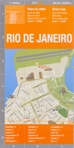
Rio de Janeiro in a series of light, laminated and waterproof concertina street plans of Latin American capitals and main cities, designed to present each city’s most visited areas. The plans are indexed and include diagrams of metro networks.The plan of Rio de Janeiro at 1:12,000 covers the districts along the Atlantic Ocean, from the airport to the Copacabana beach, with an inset extending it further east to include the Copacabana and Ipanema districts with Ipanema and Leblon beaches. A further inset extends the main plan to cover the central area of the city along the Av. Presidente Vargas. On the reverse is a street index plus a diagram of the metro network.* de Dios also publish a more tourist-oriented Map/Guide of Rio de Janeiro, covering roughly the same area and highlighting 100 attractions, all with brief descriptions, plus providing extensive other information, tourist tips, etc

Related Products:
 Rio de Janeiro de Dios Map-Guide
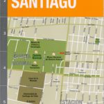 Santiago de Chile de Dios CityMap
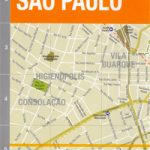 Sรฃo Paulo de Dios CityMap
 Rio de Janeiro Borch
 Rio de Janeiro Marco Polo City Map
 Santiago de Dios Map-Guide
 Barcelona Michelin Citymap
 DK Eyewitness Top 10 Rio de Janeiro
 Sao Paulo de Dios Map-Guide
 Lisbon Michelin Citymap
 Montreal
 Prague Borch
 Paris Michelin Citymap
 Amsterdam Michelin Citymap
 Rio de Janeiro & Brasil East Coast ITMB
 Montevideo de Dios Map-Guide
 Amsterdam Citymap & More
 Delft Citymap & More
 Bruges Citymap & More
 Leuven Citymap & More
Dordrecht Citymap & More
Netherlands/Belgium: Falk Citymap & More Pocket Street Plans
Leuven Citymap & More
Dordrecht Citymap & More
Netherlands/Belgium: Falk Citymap & More Pocket Street Plans
 Buenos Aires Street de Dios Street Plan
 Rome Michelin Citymap
 Rotterdam Falkplan Citymap & More
Maastricht – Valkenburg Citymap & More
Haarlem – Zandvoort aan Zee Citymap & More
Rotterdam Falkplan Citymap & More
Maastricht – Valkenburg Citymap & More
Haarlem – Zandvoort aan Zee Citymap & More
 Lonely Planet Rio de Janeiro City Guide
Palermo TCI Street Plan
Lonely Planet Rio de Janeiro City Guide
Palermo TCI Street Plan
 Lonely Planet Pocket Rio de Janeiro
 Kyoto & Japan West ITMB
 Buenos Aires de Dios Map-Guide
 Antwerp Falkplan Citymap & More
 Montevideo
 Rio De Janeiro: A Three-Dimensional Expanding City Guide
 Montreal Flexi Map OUT OF PRINT
 Moscow ITMB
 Art of the Street: Rio de Janeiro
 Madrid Michelin Citymap