Disclosure : This site contains affiliate links to products. We may receive a commission for purchases made through these links.
Riga ITMB
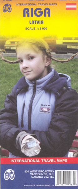
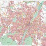
Riga Street Plan form ITMB with an enlargement for the Old Town, a map of the city’s environs and a diagram of its tram and railway networks. The plan covers the city’s central districts, highlighting various sights and facilities. Tram, trolleybus and bus routes are shown with line numbers and stops. A separate enlargement at 1:4,000 presents the Old Town, now a UNESCO World Heritage Site, in greater detail. Street index covers both the main plan and the enlargement.Also included is a map of the city’s environs at 1:300,000 with road and rail connections, plus a diagram of the tram and rail networks, including the bus connection to the international airport.

Related Products:
 Latvia & Riga ITMB
 Zurich & Switzerland NW ITMB
 Krakow ITMB
 Helsinki & Southern Finland ITMB
 Munich F&B
 Linz F&B Tourist Street Plan
 Munich F&B Wall Map
 Budapest F&B
 Frankfurt am Main Borch
 Munich F&B Wall Map – with Metal Hanging Strips
 Geneva & Switzerland ITMB
 Warsaw & Poland East ITMB
 Stockholm Borch
 Hungary & Budapest ITMB
 Istanbul & Northwest Turkey ITMB
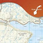
 Oslo / Bergen & South of Norway ITMB
 Tallinn Jana Seta Street Plan WATERPROOF
 Riga City Center Jana Seta Street Plan
 Osaka & Western Japan ITMB
 Helsinki City Map & Guide
 Barcelona Borch
 Riga and Vicinity Jana Seta Street Atlas
 San Diego & USA South West Border ITMB
 Amsterdam Michelin Citymap
 Prague Borch
 Maribor
 Tokyo & Central Japan ITMB
 Barcelona & Catalonia ITMB
 Shanghai & China South East ITMB
 Warsaw Marco Polo City Map
 Dresden Freytag & Berndt Map
 Zagreb F&B
 Hamburg Borch
 Estonia & Tallinn ITMB
 Munich & Bavaria ITMB
 Nuremberg Falk EXTRA Street Plan
 Berlin Borch
 Kaunas Jana Seta Street Plan WATERPROOF
 Lisbon Borch