Disclosure : This site contains affiliate links to products. We may receive a commission for purchases made through these links.
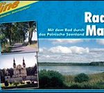
Rheinhessen Cycling Atlas
Rheinhessen Cycling Atlas in a series of handy size, 23 x 12 cm, spiral bound atlases from Verlag Esterbauer, Europe’s leading publishers of cycling maps. The guide covers cycle routes between Wiesbaden, Mainz and Worms on both sides of the Rhine.Cycling atlases from Verlag Esterbauer have a map legend which includes English and, although ALL THE TEXT IN THESE GUIDES IS IN GERMAN ONLY, information provided on the maps is sufficient to use them without any knowledge of German, particularly in the absence of similar products in English from other publishers. Please click on our sample image to see an extract from the map legend.Each atlas includes a selection of local cycling routes and tours, presented on clear, easy to follow maps. The overprint highlighting the routes indicates road surface and density of motorized traffic. Gradients, intermediate distances, danger points, and roads closed to cyclists are marked and route profiles show the degree of difficulty for each cycle path. A wide range of symbols indicate everything from covered and lockable bicycle stands, repair workshops and bike rentals to viewpoints, nature parks, leisure and sport centres, local shopping facilities, emergency services, etc. The guides also give opening hours of museums and other local places of interest. A separate section at the end of each guide list accommodation addresses with phone numbers.To see other titles in this series please click on the series link.

Related Products:
 Hamburg Cycling Atlas
 Environs of Hamburg Cycling Atlas
 Cologne – Bonn – Bergische Land Cycling Atlas
 Nuremberg and Environs Cycling Atlas
 Rhine – Neckar Cycling Atlas
 Munich and Environs Cycling Atlas
 Hamburg Surroundings Bikeline Cycling Map-Guide
 The Ruhr Bikeline Cycling Atlas
 East Frisia Cycling Region Bikeline Map-Guide
Szczecin Lagoon – Usedom Circular Cycling Routes Atlas
East Frisia Cycling Region Bikeline Map-Guide
Szczecin Lagoon – Usedom Circular Cycling Routes Atlas
 Saltzkammergut Cycling Atlas
 Upper Franconia Cycling Route
Burgenland Bikeline Cycling Atlas
Moststrasse Cycling Atlas
East Tyrol Cycling Atlas
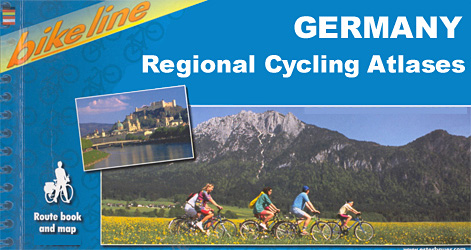
Germany: Bikeline Cycling Atlases
Upper Franconia Cycling Route
Burgenland Bikeline Cycling Atlas
Moststrasse Cycling Atlas
East Tyrol Cycling Atlas
Germany: Bikeline Cycling Atlases
 Mecklenburg Lakes Cycle Region Bikeline Map-Guide
Mรผnsterland Cycle Route Bikeleine Map-Guide
Rhine – Main River Cycle Atlas
Austria: Bikeline Cycling Atlases
Mecklenburg Lakes Cycle Region Bikeline Map-Guide
Mรผnsterland Cycle Route Bikeleine Map-Guide
Rhine – Main River Cycle Atlas
Austria: Bikeline Cycling Atlases
 Alsace Bikeline Cycling Atlas (1550km)
Carinthia Cycling Region Bikeline Map-Guide
Alsace Bikeline Cycling Atlas (1550km)
Carinthia Cycling Region Bikeline Map-Guide
 Umbria Bikeline Cycling Atlas (1020km)
 Istria Region Bikeline Cycling Atlas
Rhine Cycle Route 3 – Basel – Speyer Publicpress Cycle Touring 368
Rhine Cycle Route 4 – Speyer – Cologne Publicpress Cycle Touring 333
Rhine Cycle Route 2 – Lake Constance – Basel Publicpress Cycle Touring 302
Istria Region Bikeline Cycling Atlas
Rhine Cycle Route 3 – Basel – Speyer Publicpress Cycle Touring 368
Rhine Cycle Route 4 – Speyer – Cologne Publicpress Cycle Touring 333
Rhine Cycle Route 2 – Lake Constance – Basel Publicpress Cycle Touring 302
 Brandenburg Cycle Region Esterbauer Map-Guide
Berlin and Environs Cycle Region Bikeline Map-Guide
Brandenburg Cycle Region Esterbauer Map-Guide
Berlin and Environs Cycle Region Bikeline Map-Guide
 Tuscany Bikeline Cycling Atlas: 25 Tours (1735km)
Route of Industrial Heritage through the Ruhr by Bike
Tuscany Bikeline Cycling Atlas: 25 Tours (1735km)
Route of Industrial Heritage through the Ruhr by Bike
 Rheinhessen Cycling Map
 Lake Balaton Cycling Atlas
Lower Austria Rivers Cycle Paths Bikeline Map-Guide
Lake Balaton Cycling Atlas
Lower Austria Rivers Cycle Paths Bikeline Map-Guide
 Europe: Bikeline Map/Guides of Long-distance Cycling Routes
Denmark East Bikeline Cycling Map-Guide
Netherlands Falkplan Cycling Atlas
Europe: Bikeline Map/Guides of Long-distance Cycling Routes
Denmark East Bikeline Cycling Map-Guide
Netherlands Falkplan Cycling Atlas
 Mazury Lake District Bikeline Cycle Atlas (520km)
 Black Forest Rivers Cycling Routes Bikeline Map-Guide
 Veneto Bikeline Cycle Atlas: Lake Garda to the Adriatic Coast (1298km)