Disclosure : This site contains affiliate links to products. We may receive a commission for purchases made through these links.
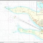
Randin CNIG Topographic Map 301-IV


Related Products:
 Far de Roses CNIG Topographic Map 259-III
Espeja CNIG Topographic Map 525-III
La Encina CNIG Topographic Map 525-IV
El Maillo CNIG Topographic Map 527-III
Valero CNIG Topographic Map 527-IV
Fuenteguinaldo CNIG Topographic Map 550-II
Robleda CNIG Topographic Map 550-IV
El Parador CNIG Topographic Map 958-I
El Granado CNIG Topographic Map 958-III
El Puertocico CNIG Topographic Map 974-IV
Tariquejos CNIG Topographic Map 981-III
Gibraleon CNIG Topographic Map 981-IV
La Celeda CNIG Topographic Map 985-I
Taberno CNIG Topographic Map 996-I
Urcal CNIG Topographic Map 996-II
El Rompido CNIG Topographic Map 999-III
El Corralejo CNIG Topographic Map 768-II
Perales del Rio CNIG Topographic Map 582-II
Valdemoro CNIG Topographic Map 582-IV
Morella CNIG Topographic Map 545-I
Palomajero CNIG Topographic Map 987-I
El Rubio CNIG Topographic Map 987-IV
Lepe CNIG Topographic Map 998-II
Ayamonye CNIG Topographic Map 998-III
Buendia CNIG Topographic Map 562-3
Las Molineras CNIG Topographic Map 994-III
Alcontar CNIG Topographic Map 994-IV
Tijola CNIG Topographic Map 995-III
A Guarda CNIG Topographic Map 298-IV
Tortosa CNIG Topographic Map 522-I
El Perello CNIG Topographic Map 497-4
Moreda CNIG Topographic Map 992-II
Darro CNIG Topographic Map 992-IV
Cabra CNIG Topographic Map 989-I
Far de Roses CNIG Topographic Map 259-III
Espeja CNIG Topographic Map 525-III
La Encina CNIG Topographic Map 525-IV
El Maillo CNIG Topographic Map 527-III
Valero CNIG Topographic Map 527-IV
Fuenteguinaldo CNIG Topographic Map 550-II
Robleda CNIG Topographic Map 550-IV
El Parador CNIG Topographic Map 958-I
El Granado CNIG Topographic Map 958-III
El Puertocico CNIG Topographic Map 974-IV
Tariquejos CNIG Topographic Map 981-III
Gibraleon CNIG Topographic Map 981-IV
La Celeda CNIG Topographic Map 985-I
Taberno CNIG Topographic Map 996-I
Urcal CNIG Topographic Map 996-II
El Rompido CNIG Topographic Map 999-III
El Corralejo CNIG Topographic Map 768-II
Perales del Rio CNIG Topographic Map 582-II
Valdemoro CNIG Topographic Map 582-IV
Morella CNIG Topographic Map 545-I
Palomajero CNIG Topographic Map 987-I
El Rubio CNIG Topographic Map 987-IV
Lepe CNIG Topographic Map 998-II
Ayamonye CNIG Topographic Map 998-III
Buendia CNIG Topographic Map 562-3
Las Molineras CNIG Topographic Map 994-III
Alcontar CNIG Topographic Map 994-IV
Tijola CNIG Topographic Map 995-III
A Guarda CNIG Topographic Map 298-IV
Tortosa CNIG Topographic Map 522-I
El Perello CNIG Topographic Map 497-4
Moreda CNIG Topographic Map 992-II
Darro CNIG Topographic Map 992-IV
Cabra CNIG Topographic Map 989-I
 Llucmajor CNIG 25K Topographic Map 724-1
Cain CNIG Topographic Map 55-4
Selva CNIG 25K Topographic Map 671-1
Torrebarrio CNIG Topographic Map 77-4
Murcia CNIG Topographic Map 934-1
Orba CNIG Topographic Map 822-I
Llucmajor CNIG 25K Topographic Map 724-1
Cain CNIG Topographic Map 55-4
Selva CNIG 25K Topographic Map 671-1
Torrebarrio CNIG Topographic Map 77-4
Murcia CNIG Topographic Map 934-1
Orba CNIG Topographic Map 822-I