Disclosure : This site contains affiliate links to products. We may receive a commission for purchases made through these links.
Rรผgen – Hiddensee – Stralsund K+F Outdoor 14
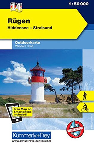
Rรผgen Island on the Baltic coast of Germany at 1:50,000 from Kรผmmerly+Frey in a series GPS compatible, double-sided maps printed on durable, waterproof and tear-resistant plastic paper; contoured, with hiking and cycle routes, other recreational activities, etc.Maps in this series are at a scale of either 1:50,000 or 1:35,000. Contour interval varies from 10m to 40m according to the area and, where appropriate, the maps have finely drawn additional graphic relief to provide an excellent representation of the terrain, with plenty of names of peaks, valleys, etc, national parks or other protected areas, plus colouring/graphics indicating different types of vegetation.An overprint, graded according to the difficulty of the route, highlights hiking trails indicating their waymarking. Also marked are local and long-distance cycle routes, plus a selection of mountain-bike trails, cross-country and alpine ski routes and horse-riding paths. A wide range of symbols indicate locations for other outdoor activities: climbing, paragliding, toboggan runs, sailing or surfing, etc. Also marked are various sport facilities, different types of accommodations including alpine huts, campsites, youth hostels, sites of botanical or cultural interest, etc. For access the maps show local bus stops, car parks/park+ride facilities, roads with entry restrictions, etc. The maps have a 1km UTM grid. Map legend includes English.Each title also provides a road map of the region around the area covered by it.To see the complete list of titles in this series please click on the series link.

Related Products:
 Teutoburg Forest K+F Outdoor Map 45
 Tegernsee – Schliersee K+F Outdoor Map 5
 Starnberger See – Ammersee K+F Outdoor Map 27
 Pfaffenwinkel – Peissenberg – Weilheim K+F Outdoor Map 28
Kempten – Allgau – Immenstadt – Bad Grรถnenbach K+F Outdoor Map 46
Pfaffenwinkel – Peissenberg – Weilheim K+F Outdoor Map 28
Kempten – Allgau – Immenstadt – Bad Grรถnenbach K+F Outdoor Map 46
 Bad Tรถlz – Lenggries – Isarwinkel K+F Outdoor Map 4
Berchtesgaden ‘“ Bad Reichenhall ‘“ Kรถnigsee K+F Outdoor Map 8
Hochspessart – Aschaffenburg – Lohr – Wertheim K+F Outdoor Map 50
Bad Tรถlz – Lenggries – Isarwinkel K+F Outdoor Map 4
Berchtesgaden ‘“ Bad Reichenhall ‘“ Kรถnigsee K+F Outdoor Map 8
Hochspessart – Aschaffenburg – Lohr – Wertheim K+F Outdoor Map 50
 Hanover – Steinhuder Meer – Deister K+F Outdoor Map 57
 Oberstdorf – Kleinwalsertal – Sonthofen – Oberstaufen K+F Outdoor Map 1
 Obere Donau – Baar – Donaueschingen K+F Outdoor Map 53
 Bavarian Forest NP – Bodenmais – Zwiesel – Grafenau K+F Outdoor Map 54
 Lake Constance West – Konstanz – Radolfzell K+F Outdoor Map 43
 Wendelstein – Rosenheim – Bayrischzell – Kufstein K+F Outdoor Map 6
Altmรผhltal – Eichstรคtt – Beilngries – Kelheim K+F Outdoor Map 38
Wendelstein – Rosenheim – Bayrischzell – Kufstein K+F Outdoor Map 6
Altmรผhltal – Eichstรคtt – Beilngries – Kelheim K+F Outdoor Map 38
 Central Moselle Valley – Trier to Zell K+F Outdoor Map 22
Lower Rhine – Kleve – Wesel – Xanten K+F Outdoor Map 61
Rheingau – West Taunus – Rรผdesheim – Wiesbaden K+F Outdoor Map 51
Central Moselle Valley – Trier to Zell K+F Outdoor Map 22
Lower Rhine – Kleve – Wesel – Xanten K+F Outdoor Map 61
Rheingau – West Taunus – Rรผdesheim – Wiesbaden K+F Outdoor Map 51
 Thuringian Forest – Rennsteig from Eisenach to Neuhaus K+F Outdoor Map 47
 Feldberg – Upper Black Forest – Titisee K+F Outdoor Map 26
Franconian Switzerland – Wiesenttal – Pottenstein K+F Outdoor Map 37
Feldberg – Upper Black Forest – Titisee K+F Outdoor Map 26
Franconian Switzerland – Wiesenttal – Pottenstein K+F Outdoor Map 37
 Eifel National Park – Ahrtal K+F Outdoor Map 19
Freiburg im Breisgau – Kaiserstuhl – Glottertal – Schaunisland K+F Outdoor Map 25
Eifel National Park – Ahrtal K+F Outdoor Map 19
Freiburg im Breisgau – Kaiserstuhl – Glottertal – Schaunisland K+F Outdoor Map 25
 Brocken – Oberharz – Harzquerbahn – NP Harz K+F Outdoor Map 17
Taunus East – Grosser Feldberg – Kรถnigstein – Bad Homberg K+F Outdoor Map 33
High Eifel – Vulkaneifel – Nรผrburgring – Daun – Gerolstein K+F Outdoor Map 20
Brocken – Oberharz – Harzquerbahn – NP Harz K+F Outdoor Map 17
Taunus East – Grosser Feldberg – Kรถnigstein – Bad Homberg K+F Outdoor Map 33
High Eifel – Vulkaneifel – Nรผrburgring – Daun – Gerolstein K+F Outdoor Map 20
 Oberstaufen – Westallgรคu – Adelegg – Lindenberg – Isny – Wangen K+F Outdoor Map 55
Lake Constance East – Friedrichshafen – Lindau – Ravensburg – Rorschach K+F Outdoor Map 44
Black Forest – Pforzheim – Baden-Baden K+F Outdoor Map 52
Frรคnkisches Weinland – Wรผrzburg – Kitzingen – Ochsenfurt – Volkach K+F Outdoor Map 56
Oberstaufen – Westallgรคu – Adelegg – Lindenberg – Isny – Wangen K+F Outdoor Map 55
Lake Constance East – Friedrichshafen – Lindau – Ravensburg – Rorschach K+F Outdoor Map 44
Black Forest – Pforzheim – Baden-Baden K+F Outdoor Map 52
Frรคnkisches Weinland – Wรผrzburg – Kitzingen – Ochsenfurt – Volkach K+F Outdoor Map 56
 Frรคnkische Schweiz K+F Outdoor Map 37
Lower Moselle – Cochem to Koblenz – Mayen – Burg Eitz K+F Outdoor Map 21
Rhรถn – Hohe Rhรถn – Wasserkuppe – Milseburg K+F Outdoor Map 23
Mรผritz National Park – Waren – Plauer See – Neusterlitz K+F Outdoor Map 16
Frรคnkische Schweiz K+F Outdoor Map 37
Lower Moselle – Cochem to Koblenz – Mayen – Burg Eitz K+F Outdoor Map 21
Rhรถn – Hohe Rhรถn – Wasserkuppe – Milseburg K+F Outdoor Map 23
Mรผritz National Park – Waren – Plauer See – Neusterlitz K+F Outdoor Map 16
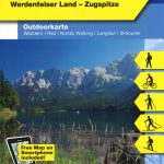 Garmisch-Partenkirchen – Wettersteingebirge K+F Outdoor Map 3
Upper Central Rhine – Koblenz to Bingen – Loreley – Rรผdesheim K+F Outdoor Map 32
Garmisch-Partenkirchen – Wettersteingebirge K+F Outdoor Map 3
Upper Central Rhine – Koblenz to Bingen – Loreley – Rรผdesheim K+F Outdoor Map 32
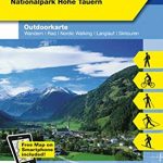 Bad Gastein K+F Outdoor Map 16
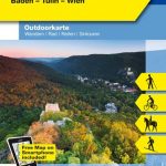 Vienna Woods / Wienerwald K+F Outdoor Map 20
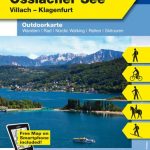 Wรถrthersee – Ossiacher See K+F Outdoor Map 17
 Wiener Hausberge K+F Outdoor Map 21