Disclosure : This site contains affiliate links to products. We may receive a commission for purchases made through these links.
Queensland Hema Handy Map

Queensland presented by Hema at 1:2,500,000 on double-sided, handy size map with a distance table. The map uses the same cartography as the publishers’ larger size map of Queensland but does not include additional enlargements and street plans provided in that version.Road network from main highways, shown with their names in addition to numbers, to minor roads and 4WD tracks indicates unsealed routes and rough tracks. Driving distances are marked on main and many smaller local roads. Railway lines and local airports or airstrips are included. Symbols highlight roadside rest areas, 24h fuels supplies, as well as campsites and caravan parks, places of interest, visitor information centres, etc. Colouring indicates national parks and other protected areas including marine parks, Aboriginal lands and restricted entry zones. Topography is shown by relief shading with plenty of names of mountain ranges, etc, and in the Great Barrier Reef World Heritage Area numerous reefs are named. The map has a latitude/longitude grid at intervals of 2ยบ.To the larger version and other titles in this series please click on the series link.

Related Products:
 Queensland Hema
 South East Queensland Hema
 South East Queensland – featuring Landcruiser Mountain Park Hema Explorer Map
North Queensland – from Cape York to Mackay Hema Explorer Map
South East Queensland – featuring Landcruiser Mountain Park Hema Explorer Map
North Queensland – from Cape York to Mackay Hema Explorer Map
 Outback Queensland Hema
 Central Queensland Hema
 Central Queensland – Hervey Bay to Mackay Hema
Outback Queensland – Camooweal to Stanthorpe Hema Explorer Map
Central Queensland – Hervey Bay to Mackay Hema
Outback Queensland – Camooweal to Stanthorpe Hema Explorer Map
 Australia – State Capitals Street & Suburbs Hema
 Australia Hema Handy Atlas SPIRAL-BOUND
 Australia: Hema State Road Maps
 Savannah Way – Cairns to Broome Hema Touring Map
 Victoria Hema
 Northern Territory Hema
 South Australia Hema
 Australia Hema Road & Terrain Map
 Top End and Gulf Hema Waterproof Map
 Flinders Ranges SA Hema
 Brisbane to Cairns Hema
 South East Queensland – 4WD + Camping Escapes Atlas & Guide A4 SPIRAL-BOUND
 Sydney to Brisbane Hema
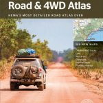 Australia Hema Road & 4WD Atlas PAPERBACK
 Australia Hema Road & 4WD Easy Read Atlas SPIRAL-BOUND
 Western Australia Hema
 Cape York – Old Telegraph Track Hema
 Australia Hema Road & 4WD Touring Atlas A4 SPIRAL-BOUND
 Australia Hema Road & 4WD Atlas SPIRAL-BOUND
 Red Centre – Alice Springs to Uluru NT Hema
 Australia Hema Motorcycle Atlas Set – 200 Top Rides SPIRAL-BOUND
 Western Australia Hema Road & 4WD Track Atlas A4 SPIRAL-BOUND
 Great Desert Tracks Eastern Hema Map
 New Zealand Hema Touring Atlas A4 SPIRAL-BOUND
 Great Desert Tracks – Simpson Desert Hema Map
 Central Australia Hema 4WD Explorer Map
 Gold Coast and Region Hema
 Cape York Hema Atlas & Guide A4 SPIRAL-BOUND
 Australia Eastern Reise Know-How
Tasmania Hema
Australia Eastern Reise Know-How
Tasmania Hema
 The Kimberley – Gibb River Road Hema
 Outback New South Wales – from Broken Hill to Tamworth Hema Explorer Map