Disclosure : This site contains affiliate links to products. We may receive a commission for purchases made through these links.
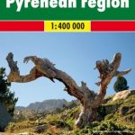
Pyrenees Reise Know-How
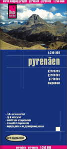
Pyrenees at 1:250,000 on a light waterproof and tear-resistant, indexed road map from Reise Know-How. The map, part of the publishers’ highly acclaimed World Mapping Project, is double-sided to provide the best balance between a good scale and a convenient size sheet, covering the Pyrenees.The region’s topography is well presented by light altitude colouring with spot heights. Boundaries of national and regional parks are marked. Road network includes local roads and selected country tracks, with driving distances marked on main and on secondary routes. Railway lines are included and ferry connections to the islands are shown. A range of symbols highlight numerous places of interest, including UNESCO World Heritage sites, historical buildings and archaeological remains, recreational facilities, etc. The map is indexed and has latitude and longitude lines at intervals of 15’, plus a UTM grid. Map legend includes English.

Related Products:
 Scotland Reise Know-How
 Philippines Reise Know-How
 Corsica Reise Know-How
 Tuscany Reise Know-How
 Bosnia-Herzegovina – Montenegro Reise Know-How
 Denmark Reise Know-How
 Sulawesi Reise Know-How
 Malaysia Reise Know-How
 Philippines F&B
 Ireland Reise Know-How
 Japan Reise Know-How
 Sumatra Reise-Know-How Map
 Indonesia: Reise-Know How Regional Maps
 Pyrenees 350K Editorial Alpina Road Map
 Norway South Reise Know-How
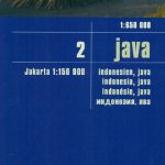 Java Reise Know-How
 Western Balkans Reise Know-How
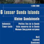 Lesser Sunda Islands – Bali to East Timor Reise Know-How
 Sri Lanka Reise Know-How
 Pyrenees F&B
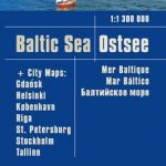 Baltic Sea Reise Know-How
 Trinidad and Tobago Reise Know-How
 Italy Reise Know-How
 Madagascar Reise Know-How
 Cape Verde Islands Reise Know-How
 Ecuador – Galapagos Islands Reise Know-How
 Taiwan Reise Know-How
 Angola Reise Know-How
 Canada East Reise Know-How
 Azerbaijan Reise Know-How
 Egypt Reise Know-How
 Argentina Reise Know-How
 Baltic States Reise Know-How
 Greenland Reise Know-How
 Rhodes Reise-Know-How
 Tibet Reise Know-How
 Thailand Reise Know-How
 Istria Reise Know-How
 Peru Reise Know-How
 Bali – Lombok – Komodo Reise Know-How