Disclosure : This site contains affiliate links to products. We may receive a commission for purchases made through these links.
Pyrenees Rando Editions
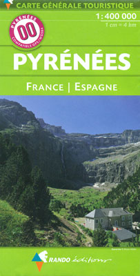
Pyrenees coast to coast and across both sides of the border presented by Rando Editions on a map at 1:400,000 with coverage extending from Auch, Toulouse and Bรฉziers in France to Bilbao, Logroรฑo, Zaragoza, Lleida and Barcelona in Spain; plus prominent highlighting of the region’s national / natural parks.Relief shading and altitude colouring presents the region’s topography, with names of valleys, peaks, passes, etc. National parks and other protected areas are prominently marked. Road network includes selected local roads, although fewer than on similar coverage from other publishers. Symbols highlight locations worth visiting and other places of interest or areas for recreational pursuits. The map has no geographical coordinates for GPS (contrary to the icon on its cover!). Map legend includes English. Accompanying text about various aspects of the region, illustrated with photos and maps, is in French only.

Related Products:
 Bรฉarn – Aspe – Ossau – Pyrenees National Park Rando Editions 3
 Bigorre – Cauterets – Gavarnie – Saint-Lary-Soulan – Pyrenees NP Rando Editions 4
 Belledonne Rando Editions
 France: Rando Editions/IGN 50K Walking Maps of the Pyrenees
 Pyrenees 350K Editorial Alpina Road Map
 Beaufortain Rando Editions
Vanoise Rando Editions
Ecrins Rando Editions
Beaufortain Rando Editions
Vanoise Rando Editions
Ecrins Rando Editions
 Mont Blanc Rando Editions
 Pyrenees Reise Know-How
France: Rando Editions 50K Walking Maps of the French Alps
Pyrenees Reise Know-How
France: Rando Editions 50K Walking Maps of the French Alps
 Pays Basque West Rando Editions 1
 Le Sentier Cathare – Queribus – Peyrepertuse Rando Editions 9
 Pyrenees F&B
 Couserans-Val d`Aran Rando Editions 6
 Haute-Ariรฉge Rando Editions 7
 Canigou-Garrotxa Rando Editions 10
 Luchon Rando Editions 5
 Eastern Crete Terrain Editions 450
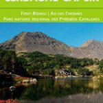 Cerdagne-Capcir Rando Editions 8
 Finistรจre Sud – Quimper ‘“ Douarnenez ‘“ Pont-l’Abbรฉ Rando Editions
 Central Crete Terrain Editions 449
 Western Crete Terrain Editions 448
 France Southwest Michelin
 Ile d`Olรฉron – Ile de Rรฉ Rando Editions
 Finland Road Atlas GLOVEBOX, SPIRAL-BOUND
 Greece: Terrain Editions 100K Touring Maps of Crete
 Zimbabwe InfoMap
 Collioure-Cadaquรฉs Rando Editions 11
 Pyrenees – Costa Brava – Basque Country – Navarra – Aragon – Andorra – Catalonia
 Gavarnie-Ordesa Rando Editions 12
 Lauca & Surire
 Pays Basque East Rando Editions 2
 Poland 700K F&B
 Evia / Euboea Terrain Editions
 Chalkidiki / Halkidiki – Thessaloniki Street Plan Terrain Editions 412
 Skopelos Orama Editions 348
 Gold Coast and Region Hema
 Central Pyrenees terraQuest Trekking Map