Disclosure : This site contains affiliate links to products. We may receive a commission for purchases made through these links.
Pyrรฉnรฉes Orientales et tours du Capcir, du Carlit et de Cerdagne GR10/GR36
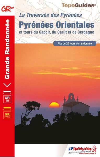
More than 30 days of hiking, including 12 to join Banyuls in Mรฉrens-les-Vals.Pyrรฉnรฉes Orientales, FFRP topoguide, Ref. No. 1092, covering the fourth and last section of the GR10 along the Pyrenees from the Atlantic to the Mediterranean ‘“ a 196-km long walk from Mรฉrens-les-Vals to Banyuls-sur-Mer. The guide also covers a 177-km trail along the GR 36 from St-Paul-de Feouillet to Bourg-Madame, plus three shorter local circuits in the Cerdagne – Capcir area of the Pyrenees. Given the mountainous terrain, the guide also provides a detailed route profiles for this part of the GR10 and the three tours, annotated with timings in either direction plus locations of accommodation facilities. Current edition of this title was published in July 2019.The Eastern Pyrenees are known as one of the most beautiful hiking stadiums, which is far from surprising given the countless different views and panoramas that come together.This guidebook includes several trails that intersect and mix to offer many opportunities for hikers.Thus, in Bourg-Madame you will have the choice between GRP Tour de Cerdagne and GR36 and in Mantet it will be GR36 and GR10.To see other titles in this series please click on the series link.ABOUT THE FFRP (Fรฉdรฉration franรงaise de la randonnรฉe pรฉdestre) TOPOGUIDES: published in a handy A5 paperback format, the guides are the best companions for hiking along the GR routes, France’s extensive network of long-distance footpaths. Each topo-guide covers either a whole route or a part of a longer path (e.g. four titles for the GR 10 along the Pyrenees). The guides have COLOUR extracts from IGN`s 1:50,000 or 1:25,000 topographic survey mapping overprinted with the route, with important points cross-referenced to the accompanying text placed on the adjoining page. The text is in French, but a large amount of information is conveyed by symbols (different types of accommodation, food shops, public transport links, etc). An important feature of each guide is a summary table showing what facilities can be found at each stage of the route, supported by an extensive ‘info practiques” section with more specific information and contact details for recommended accommodation, tourist offices, etc. The guides are published on high quality paper and include descriptions of the most interesting aspects of the surrounding region: historical and cultural sites, local specialties, fauna and flora, etc, all illustrated with colour photos.

Related Products:
 Pyrรฉnรฉes Ariรฉgeoises – La traversรฉe des Pyrรฉnรฉes et tours du Val du Garbet et du Biros GR10
 Pyrรฉnรฉes Occidentales – Pays basque – Bรฉarn GR8/GR10
 Cerdagne-Capcir Rando Editions 8
Pyrenees Centrales et tours du Val d`Azun et d`Oueil-Larboust GR10/GR101
Cerdagne-Capcir Rando Editions 8
Pyrenees Centrales et tours du Val d`Azun et d`Oueil-Larboust GR10/GR101
 Les Pyrรฉnรฉes Orientales ร pied D066
 The GR10 Trail: Through the French Pyrenees: The Sentier Des Pyrenees
 GRP: Tours et Ronde du Canigรณ FFRP Topo-guide No. 6600
 GR36/36A: Traversรฉe de l`Aude – Pays Cathare FFRP Topo-guide No. 360
 GRP: Ariรจge-Pyrรฉnรฉes ‘“ Andorre – Catalogne FFRP Topo-guide No. 1098
Les Hautes-Pyrรฉnรฉes ร pied
GRP: Ariรจge-Pyrรฉnรฉes ‘“ Andorre – Catalogne FFRP Topo-guide No. 1098
Les Hautes-Pyrรฉnรฉes ร pied
 GR62B/GR36/GR46 Le Chemin de Conques ร Toulouse FFRP Topo-guide No. 3646
 GR59/GR9/GRP: Tours et Traversรฉes de l`Ain FFRP Topo-guide No. 901
 GR de Pays: Tours en Hautes Terres d`Oc FFRP Topo-guide No. 811
 GR9/GR96/GRP: Tours et Traversรฉes de Chartreuse FFRP Topo-guide No. 903
Tours et Traversรฉes du Massif des Bauges GR96
GR9/GR96/GRP: Tours et Traversรฉes de Chartreuse FFRP Topo-guide No. 903
Tours et Traversรฉes du Massif des Bauges GR96
 GR93/GR94 Tours dans les Hautes-Alpes FFRP Topo-guide No. 940
 GRP Tours dans le Pays Haut Languedoc et Vignobles FFRP Topo-guide No. 3400
Tours et Traversรฉes du Vercors – du Diois et les Baronnies GR9/GR91
GRP Tours dans le Pays Haut Languedoc et Vignobles FFRP Topo-guide No. 3400
Tours et Traversรฉes du Vercors – du Diois et les Baronnies GR9/GR91
 Aude – Pyrรฉnรฉes-Orientales Michelin Local 344
L`Ariรจge ร pied – du Piรฉmont aux Pyrรฉnรฉes
Aude – Pyrรฉnรฉes-Orientales Michelin Local 344
L`Ariรจge ร pied – du Piรฉmont aux Pyrรฉnรฉes
 The Pyrenees: The High Pyrenees from the Cirque de Lescun to the Carlit Massif
Tours dans le Luberon et les Monts de Vaucluse
The Pyrenees: The High Pyrenees from the Cirque de Lescun to the Carlit Massif
Tours dans le Luberon et les Monts de Vaucluse
 GR654 Sentier St-Jacques: Perigueux – Roncevaux FFRP Topo-guide No. 6543
 GR de Pays: Ouest des Vosges FFRP Topo-guide No. 881
 GRP: Monts et Lacs du Lรฉvรฉzou FFRP Topo-guide No. 1201
 Bourg-Madame – Pic Carlit – Col de Puymorens IGN 2249OT
Tour des Monts d`Aubrac GRP/GR60/GR6
Bourg-Madame – Pic Carlit – Col de Puymorens IGN 2249OT
Tour des Monts d`Aubrac GRP/GR60/GR6
 GRP: La Haute Vallรฉe du Thorรฉ FFRP Topo-guide No. 812
 GR3: Les Monts du Forez FFRP Topo-guide No. 334
 Bourg-Madame – Pic Carlit – Col de Puymorens IGN WATERPROOF 2249OTR
Tour du Cotentin – Littorral de la Normandie GR223
Bourg-Madame – Pic Carlit – Col de Puymorens IGN WATERPROOF 2249OTR
Tour du Cotentin – Littorral de la Normandie GR223
 GR654 Chemins de St-Jacques: Vรฉzelay – Pรฉrigueux FFRP Topo-guide No. 6542
Tour du Queyras GR58
France: FFRP Topo-guides to Long-distance Footpaths
Tour du Larzac, Templier – Hospitalier – Entre causses et vallรฉes GR71C/GR71D
Sentiers de St-Jacques via le Puy – Le Puy to Figeac GR65
GR654 Chemins de St-Jacques: Vรฉzelay – Pรฉrigueux FFRP Topo-guide No. 6542
Tour du Queyras GR58
France: FFRP Topo-guides to Long-distance Footpaths
Tour du Larzac, Templier – Hospitalier – Entre causses et vallรฉes GR71C/GR71D
Sentiers de St-Jacques via le Puy – Le Puy to Figeac GR65
 GRP Robe de Bure et Cotte de Mailles FFRP Topo-guide No. 4303
Val d`Azun ร pied ST10
Les Abers – le Chemin de Phares GR34/GR34F
GRP Robe de Bure et Cotte de Mailles FFRP Topo-guide No. 4303
Val d`Azun ร pied ST10
Les Abers – le Chemin de Phares GR34/GR34F
 GR653D Chemins de St-Jacques: Montgenรจvre – Arles FFRP Topo-guide No. 6531