Disclosure : This site contains affiliate links to products. We may receive a commission for purchases made through these links.
Puyehue
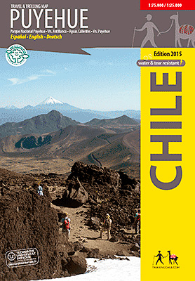
Puyehue at 1:75,000 on a contoured, GPS compatible map form Trekkingchile, printed on light, waterproof and tear-resistant synthetic paper. The main map is at 1:75,000, with insets for Anticura (enlarged at 1:25,000) and Antillanca (at 1:40,000). Contours are at 50m intervals with colouring and graphics showing different types of vegetation. The map shows local roads, paths and trekking trails, as well as shipping routes on the lakes. Symbols highlight various accommodation facilities (hotels, campsites, refuges), eateries and grocery stores, sport and recreational sites, etc. The map has a 2-km UTM grid, plus margin ticks for latitude and longitude at 1’.Maps in the Trekkingchile series use satellite imagery as a base, with contour lines and colouring to indicate different types of terrain and habitats. Unless indicated to the contrary in the individual descriptions, the maps have a UTM grid, plus margin ticks for latitude and longitude. The maps are annotated with tourist information and most titles include a street plan of the region’s main town. Many are illustrated with drawings of local fauna or flora. Map legends and other text include English.To see the other titles in this series please click on the series link.

Related Products:
 Huilo Huilo Biological Reserve Trekkingchile Map
 Chile: Trekkingchile Hiking and Exploration Maps
 Melado – Volcรกn San Pedro
 Santiago Environs
 Condor Circuit
Nevados de Chillรกn
Condor Circuit
Nevados de Chillรกn
 Rรญo Los Cipreses National Reserve
 Cajรณn del Maipo – Volcรกn San Josรฉ
 Lake Llanquihue and Surrounding Region
 Antuco – Laguna del Laja National Park
 Torres del Paine 50K/100K Trekkingchile Map
 Laguna del Maule – Winter Trails
 Cabo Froward
 Costa del Maule
 Pucon – Villarrrica NP – Huerquehue NP
 Yanahuanca
Corongo
Huari
Ocongate
Paras
La Union
Cajamarca
Carhuรกs
Huaraz
Sicuani
Characato
Jaen
Moho
Azangaro
Putina
Machupicchu
Condoroma
Callalli
Pacaypata
Parobamba
Chontachaca
Poyeni
Cutivireni
Ichuรฑa
Cusco
Yanahuanca
Corongo
Huari
Ocongate
Paras
La Union
Cajamarca
Carhuรกs
Huaraz
Sicuani
Characato
Jaen
Moho
Azangaro
Putina
Machupicchu
Condoroma
Callalli
Pacaypata
Parobamba
Chontachaca
Poyeni
Cutivireni
Ichuรฑa
Cusco