Disclosure : This site contains affiliate links to products. We may receive a commission for purchases made through these links.
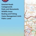
Puget Sound and Greater Seattle, WA
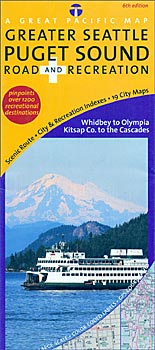
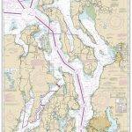
Puget Sound and Greater Seattle Road and Recreation Map from the Great Pacific Recreation & Travel Maps with clear cartography, numerous town maps and very extensive tourist information about recreational facilities, places of interest, transport, etc.The main map at 1:135,100 approx presents the area on both sides of the Puget Sound, including the Seattle conurbation, and extends south beyond Tacoma, east to Fall City, and north to Marysville. Road network is very clearly laid out, showing, where appropriate, names of local roads. Campgrounds and RV parks are marked, as well many other recreational facilities and places of interest including wildlife watching sites, breweries and wineries, etc. Colouring indicates national/state parks and other protected areas as well as Indian Reservations. The map has latitude and longitude margin ticks at 7’30″. On the reverse a map at 1:250,000 approx. extends coverage further north to the Canadian border. Numerous enlargement and street plans provide more detailed coverage of urban areas: downtown Seattle, Tacoma and Olympia, plus central Bremerton, Gig Harbor, Poulsbo, Coupeville, Everett, Edmonds, Bellevue, Woodinville, Snoqualmie Valley, Bellingham, Skyline – Washington Park, Anacortes, Snohomish, La Conner, and Burlington – Mount Vernon. Also provided are panels with maps of Thurston County and the Mount Rainer area, both south of the coverage by the main map.Numerous information panels provide very extensive lists of additional tourist information: campgrounds, parks and recreation areas, hiking trails, golf courses, museums, theatres, casinos, shopping centres, transport terminals and facilities, wineries, etc.

Related Products:
 Puget Sound WA Regional Rand McNally
 Seattle Borch
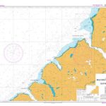
 Admiralty Chart 50 – Puget Sound, Seattle Harbor
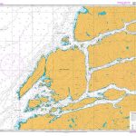
 NOAA Chart 18449 – Puget Sound’”Seattle to Bremerton
 Seattle & Northwest USA ITMB
 Vancouver to Calgary MapArt Back Road Atlas
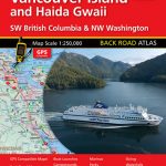 Vancouver Island and Haida Gwaii – SW British Columbia Back Road Atlas
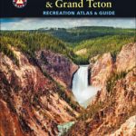 Greater Yellowstone & Grand Teton Benchnark Maps Recreation Atlas & Guide
 Seattle WA Rand McNally
 Olympic Peninsula and Washington Coast, WA
 Oregon Central
 Alaska`s Inside Passage – Seattle to Anchorage ITMB
 A Cruising Guide to Puget Sound and the San Juan Islands
 Oregon & Northern California Coast Road & Recreation Map
 Washington State Road & Recreation Atlas
 San Juan Islands WA
 DK Eyewitness Top 10 Seattle 14/5/20
 Not For Tourists Guide to Seattle 2018
 DK Eyewitness Top 10 Seattle
 Fiordland: Milford Sound, Te Anu, Manapouri, Otautau
 Washington State Benchmark Recreation Map
 Moon Seattle
 Kayaking the Inside Passage – A Paddler`s Guide from Puget Sound, Washington, to Glacier Bay, Alaska
 Frommer`s EasyGuide to Seattle, Portland and the Oregon Coast
 Pennsylvania Recreation Atlas
 Prince William Sound West AK NGS Trails Illustrated Map 761
 Finger Lakes, NY Qickmap
 NZ7625 Thompson Sound and Doubtful Sound / Patea
 Southwest British Columbia & Northern Washington Gem Trek
 NZ7622 Milford Sound / Piopiotahi to Sutherland Sound
 Utah Benchmark Recreation Map
 NZ7653 Breaksea Sound and Dusky Sound
 NZ7623 Bligh Sound to Caswell Sound
 Walking Seattle: 35 Tours of the Jet City`s Parks, Landmarks, Neighborhoods, and Scenic Views
 Fodor`s Seattle
 NZ7624 Charles Sound to Dagg Sound
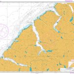
 NOAA Chart 18441 – Puget Sound (northern part)
 Reg 3.1 Rhode Is to Nantucket Sound
 Seattle WA Red Maps
 Admiralty Chart 51 – Puget Sound Point Defiance to Olympia