Disclosure : This site contains affiliate links to products. We may receive a commission for purchases made through these links.
Puerto Rico & US Virgin Islands ITMB

Related Products:
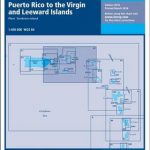 A2 Puerto Rico to the Virgin and Leeward Islands
 Puerto Rico, the Spanish, US and British Virgin Islands
 NOAA Charts for Puerto Rico and Virgin Islands
 NOAA Chart 25640 – Puerto Rico and Virgin Islands
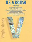
 Virgin Islands (US and British) ITMB
 Admiralty Chart 2016 – Puerto Rico to Leeward Islands
 NOAA Chart 25668 – North Coast of Puerto Rico’”Punta Peรฑon to Punta Vacia Talega – Puerto Arecibo – Puerto Palmas Altas
 Imray Chart A231: Virgin Islands St Thomas to Virgin Gorda: 2019
 NOAA Chart 25641 – Virgin Islands’”Virgin Gorda to St. Thomas and St. Croix – Krause Lagoon Channel
 A231 Virgin Islands: St Thomas to Virgin Gorda
 Puerto Rico NGS Adventure Map 3107
 Puerto Rico CNIG Topo 1106
 Caribbean National Forest – Puerto Rico NGS Trails Illustrated Map 790
 A1 Puerto Rico
Puerto Rico
A1 Puerto Rico
Puerto Rico
 Reg 11.1 Puerto Rico
 DK Eyewitness Top 10 Puerto Rico
 Fodor`s Puerto Rico
 Flag of Puerto Rico
 Moon Puerto Rico (Fifth Edition)
 Lonely Planet Puerto Rico
 A Cruising Guide to Puerto Rico
 Insight Guides Puerto Rico
 Puerto Rico Flag – 1/2 yard – Printed
 Admiralty Chart 3408 – Puerto Rico
 Puerto Rico: The Trials of the Oldest Colony in the World
 SHOM Chart 7474 – De Cuba ร Puerto Rico
 SHOM Chart 7475 – De Puerto Rico ร Trinidad
 Admiralty Chart 3001 – Cuba to Puerto Rico
 NOAA Chart 25671 – West Coast of Puerto Rico
 Cocina Tropical: The Classic and Contemporary Flavours of Puerto Rico
 The Battle For Paradise: Puerto Rico Takes on the Disaster Capitalists
 Virgin Islands (US and British)
 Virgin Islands Borch
 Birdwatchers` Guide to Cuba, Jamaica, Hispaniola, Puerto Rico & the Caymans
 SHOM Chart 7475L – De Puerto Rico ร Trinidad – Leisure A4 size
 Virgin Islands National Park
 Virgin Islands (GB/USA) Flexi Map OUT OF PRINT
 British Virgin Islands Franko`s Map-Guide
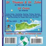 US Virgin Islands Adventure and Dive Map/Guide