Disclosure : This site contains affiliate links to products. We may receive a commission for purchases made through these links.
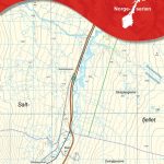
Puente La Reina/Gares CNIG Topo 141-3

Related Products:
 Camino de Santiago: Stages 5/5a/6/6a, Sangรผesa/Puente la Reina/Los Arcos 50K CNIG Map
Camino de Santiago: Stages 1n/2n/3n/4n, Saint-Jean-Pied-de-Port/Puente la Reina 50K CNIG Map
Camino de Santiago: Stages 5/5a/6/6a, Sangรผesa/Puente la Reina/Los Arcos 50K CNIG Map
Camino de Santiago: Stages 1n/2n/3n/4n, Saint-Jean-Pied-de-Port/Puente la Reina 50K CNIG Map
 The Way of St James in France: Toulouse to Puente la Reina
 El Puente CNIG Topo 267-2
 Quintana del Puente CNIG Topo 274-2
Puente de Domingo Florez CNIG Topo 191-3
Talavera de la Reina CNIG Topo 627
El Puente del Arzobispo CNIG Topo 654
Puente-Genil CNIG Topo 988
Puente de Domingo Florez CNIG Topo 191
Talavera de la Reina CNIG Topographic Map 627-I
Pinos Puente CNIG Topographic Map 1009-I
Portilla de la Reina
Dehesa de la Puente
Gor CNIG Topo 993-4
Ena CNIG Topo 209-1
Ara CNIG Topo 210-1
Foz CNIG Topo 9-4
Ona CNIG Topo 136-3
Lobrega CNIG Topo 930-3
Arbeteta CNIG Topo 513-3
Monterroso CNIG Topo 123-1
Villacastin CNIG Topo 507-1
Ablanque CNIG Topo 488-4
Tinajas CNIG Topo 585-2
Pozorrubio CNIG Topo 660-2
La Berruga CNIG Topo 763-1
Valdepenas CNIG Topo 812-1
Ferez CNIG Topo 867-4
Cambas CNIG Topo 46-2
A Fonsagrada CNIG Topo 74-1
Calahorra CNIG Topo 243-2
Garralda CNIG Topo 116-2
Rada CNIG Topo 244-2
Xermade CNIG Topo 23-3
Sabero CNIG Topo 105-3
Molinaseca CNIG Topo 159-3
Sames CNIG Topo 55-1
Palencia CNIG Topo 273-4
Campolara CNIG Topo 277-1
Quintana del Puente CNIG Topo 274-2
Puente de Domingo Florez CNIG Topo 191-3
Talavera de la Reina CNIG Topo 627
El Puente del Arzobispo CNIG Topo 654
Puente-Genil CNIG Topo 988
Puente de Domingo Florez CNIG Topo 191
Talavera de la Reina CNIG Topographic Map 627-I
Pinos Puente CNIG Topographic Map 1009-I
Portilla de la Reina
Dehesa de la Puente
Gor CNIG Topo 993-4
Ena CNIG Topo 209-1
Ara CNIG Topo 210-1
Foz CNIG Topo 9-4
Ona CNIG Topo 136-3
Lobrega CNIG Topo 930-3
Arbeteta CNIG Topo 513-3
Monterroso CNIG Topo 123-1
Villacastin CNIG Topo 507-1
Ablanque CNIG Topo 488-4
Tinajas CNIG Topo 585-2
Pozorrubio CNIG Topo 660-2
La Berruga CNIG Topo 763-1
Valdepenas CNIG Topo 812-1
Ferez CNIG Topo 867-4
Cambas CNIG Topo 46-2
A Fonsagrada CNIG Topo 74-1
Calahorra CNIG Topo 243-2
Garralda CNIG Topo 116-2
Rada CNIG Topo 244-2
Xermade CNIG Topo 23-3
Sabero CNIG Topo 105-3
Molinaseca CNIG Topo 159-3
Sames CNIG Topo 55-1
Palencia CNIG Topo 273-4
Campolara CNIG Topo 277-1