Disclosure : This site contains affiliate links to products. We may receive a commission for purchases made through these links.
Psiloritis – Mt Ida Anavasi 11.14

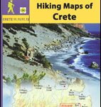
Mount Idha (Psiloritis) area at 1:30,000 in a series of contoured, GPS compatible hiking maps of Crete from Anavasi, printed waterproof and tear-resistant paper and highlighting nine recommended hiking routes in the mountains. The map is double-sided, with each side covering the same area with identical mapping, but on one side overprinted local hiking trails annotated with numbers referring to the publishers’ recommendations for nine routes. Additional markers show important points along the trails. Topography is presented by contour lines at 20m intervals, enhanced by hill-shading, altitude colouring and spot heights. Symbols show locations of mountain refuges and shelters, recreational areas, various landmarks, etc. The surrounding road network indicates difficult roads, driving distances and locations of petrol stations. Place names are in both Greek and Latin alphabet. The map has a 1-km UTM grid plus latitude and longitude cross-hairs at 1’ intervals. Map legend and the notes include English.To see all the titles in the Anavasi hiking series for Crete please click on the series link.

Related Products:
 Mt Dikti – Mt Selena Anavasi 11.15
 Tinos Anavasi 10.20
 Frangokastelo – Plakias Anavasi 11.17
 Mainalo – Artemisio – Lyrkeio – Farmakas – Ktenias Anavasi 8.5
 Zakros – Vai – Sitia Anavasi 11.16
 Lasithi – Eastern Crete Anavasi 92
 White Mountains / Lefka Ori – Sfakia – Pahnes Anavasi 11.11/11.12
 Cephalonia / Kefalonia – Ithaca Anavasi 9.3
 Greece: Anavasi Hiking Maps of Crete
 Iraklion – Rethymnon – Central Crete Anavasi 93
 Paxos – Antipaxos Anavasi 9.2
 Greece: Anavasi 100K Touring Maps of Crete
 Chania – Gavdos Anavasi 94
 Lousios Anavasi 8.51
 Crete Anavasi Adventure Atlas
 Naxos & Small Cyclades Anavasi 10.28
 Kythnos Anavasi 10.44
 Serifos Anavasi 10.25
 Prespa – Vitsi – Voras Anavasi 6.2
 Chalki Anavasi 10.33
 Northern Agrafa – Plastira Lake Anavasi 4.1
 Santorini – Thirasia Anavasi 10.24
 Mani Anavasi 8.4
 Mt Kyllinin / Ziria Anavasi 8.31
 Milos – Kimolos – Polyvos Anavasi 10.45
 Karpathos – Saria Anavasi 10.50
 Hydra Anavasi 10.40
 Exo Mani – Verga – Kardamyli – Trachila Anavasi 8.10
 Spetses Anavasi 10.30
 Rhodes & Symi Anavasi 10.38
 Mount Pelion – Mount Mavrovouni Anavasi 4.3/4.4
 Greece: Anavasi Maps of Greek Islands
 Skyros Anavasi 10.14
 Sifnos Anavasi 10.26
 Kea / Tzia Anavasi 10.41
 Syros Anavasi 10.22
 Anafi Anavasi 10.47
 Andros Anavasi 10.21