Disclosure : This site contains affiliate links to products. We may receive a commission for purchases made through these links.
Prince Albert NP, Saskatchewan

Prince Albert National Park in Saskatchewan at 1:100,000 in a series of GPS compatible recreational maps at various scales from Go Trekkers highlighting recreational possibilities including trekking and/or snowshoe trails, canoeing and kayaking routes, campgrounds, warden stations, etc.Cartography of each title varies according to the terrain of the national park, but the maps are contoured and have spot heights plus, as appropriate, graphics to show wetlands, relief shading in mountainous areas, etc. All the titles are GPS compatible with either a UTM or latitude/longitude grid.Presentation of trails, recreational facilities such as campgrounds, access to the park by road or air, etc, also varies according to what each park has to offer and where it is situated. Each map also includes notes about the park.IN THIS TITLE: the map highlights recommended hiking routes and indicates 10 suggested snow shoe and 11 cross-country ski trails. Also marked are canoe routes showing portage sections. Symbols mark locations of campgrounds, group camping and designated winter campsites, picnic sites, warden stations, marinas, lookout towers, as well as access by road and air.

Related Products:
 Grasslands National Park: East Block, Saskatchewan
Grasslands National Park; West Block Saskatchewan
Kluane NP YT
Wapusk National Park, Manitoba
Sirimilik National Park, Nunavut
Ukkusiksalik National Park, Nunavut
Vuntut National Park, Yukon
Ivvavik National Park, Yukon
Quttinirpaaq NP NU
Tuktut Nogait National Park, Northwest Territories
Canada: Go Trekkers Maps of National Parks
Nahanni National Park Reserve, Northwest Territories
Auyuittuq National Park, Nunavut
Aulavik National Park, Northwest Territories
Grasslands National Park: East Block, Saskatchewan
Grasslands National Park; West Block Saskatchewan
Kluane NP YT
Wapusk National Park, Manitoba
Sirimilik National Park, Nunavut
Ukkusiksalik National Park, Nunavut
Vuntut National Park, Yukon
Ivvavik National Park, Yukon
Quttinirpaaq NP NU
Tuktut Nogait National Park, Northwest Territories
Canada: Go Trekkers Maps of National Parks
Nahanni National Park Reserve, Northwest Territories
Auyuittuq National Park, Nunavut
Aulavik National Park, Northwest Territories
 Yosemite National Park Area
 Ottawa National Forest MI
 Saskatchewan Back Road Atlas
 Bow Lake & Saskatchewan Crossing Gem Trek Map
 Mark Twain National Forest – Houston, Rolla and Cedar Creek Ranger District
 Jasper South – Jasper National Park
 Jasper North – Jasper National Park
 Alberta & Saskatchewan
 Manitoba & Saskatchewan MapArt Road Atlas
 Prince William Sound West AK NGS Trails Illustrated Map 761
 Banff South – Banff & Kootenay National Parks
 Maritimes Provinces: New Brunswick – Nova Scotia – Prince Edward Island MapArt Back Road Atlas
 Banff North – Banff and Yoho National Parks
 Folgefonna National Park Nordeca 2663
 Alabama Recreational Atlas & Gazetteer
 Montana Recreational Atlas & Gazetteer
 Eifel National Park – Ahrtal K+F Outdoor Map 19
 Elbsandsteingebirge ‘“ Sรคchsische Schweiz National Park K+F Map 18
 Idaho DeLorme Atlas & Gazetteer
 Missouri Recreational Atlas & Gazetteer
 West Virginia Recreational Atlas & Gazetteer
 Arkansas Recreational Atlas & Gazetteer
 Florida Recreational Atlas & Gazetteer
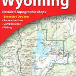 Wyoming Recreational Atlas & Gazetteer
 Kampinoski National Park
 Nebraska Recreational Atlas & Gazetteer