Disclosure : This site contains affiliate links to products. We may receive a commission for purchases made through these links.
Prato Province Hiking Routes
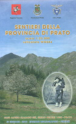
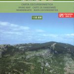
The province of Prato, just north-west of Florence, on a double-sided, contoured and GPS compatible map at 1:25,000 from Edizioni Multigraphic highlighting waymarked routes and other hiking paths, with access by public transports, etc.The map has contours at 20m intervals with relief shading and plenty of spot heights. Hiking paths are prominently highlighted, with routes waymarked by the Club Alpino Italiano (CAI) annotated with their numbers. The map also shows which of the routes form part of Sentiero Italia and GEA ‘“ Grande Escursione Appenninica. Icons indicate local villages with bus connections, mountain refuges, horse-ringing facilities, individual interesting trees, etc. Picturesque villages are highlighted. The map has a 1km UTM grid. Map legend includes English.

Related Products:
 Monti Sibillini National Park Edizioni Multigraphic 60/61
 Switzerland K+F Long-Distance Hiking Routes Map
 Italy: IGA 25K Hiking Maps of Central Italy
 Italy: IGA 50K Hiking Maps of Central Italy
 Riviera do Levante – Chiavari – Sestri Levante – Moneglia 25K Ed. Multigraphic Map No. 8
 Domodossola – Val Grande National Park Swisstopo Hiking 285T
 Santo Antรฃo AB Kartenverlag Hiking Map
 Mount Athos + hiking routes: 2016
 Florence – Siena – Chianti Kompass 2458
 Arezzo – Casentino – Foreste Casentinesi NP – Monte Falterona Kompass 2459
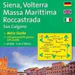 Siena – Volterra – Massa Marittima – Roccastrada Kompass 2462
 Germany – Great Hiking Routes Map and Guide Kompass 2561
 Europe – Long-Distance Hiking Routes Map and Guide Kompass 2562
 Val d`Aran: Setau Sagรจth Hiking Circuit
 Apennines Trekking – The Grande Escursione Appenninica
 Bulgaria: Domino Hiking Maps
 Tour of the Canigรณ Hiking Circuit
 Great Britain: Footprint Maps of Long-distance Hiking Routes
 Parco delle Madonie
 Alpe di San Benedetto 21
Riviera di Levante – Portofino – Golfo di Tigullio – Golfo Paradiso Edizioni Multigraphic 6
Alpe di San Benedetto 21
Riviera di Levante – Portofino – Golfo di Tigullio – Golfo Paradiso Edizioni Multigraphic 6
 Pilgrim Routes in the Florentine Countryside: Western Part
Alpe della Luna 17
Mugello – Alto Mugello 25K Ed. Multigraphic Map No. 28
Monte Fumaiolo – Monte Comero 18
Monte Carpegna – Sasso di Simone
Pilgrim Routes in the Florentine Countryside: Western Part
Alpe della Luna 17
Mugello – Alto Mugello 25K Ed. Multigraphic Map No. 28
Monte Fumaiolo – Monte Comero 18
Monte Carpegna – Sasso di Simone
 The Hermitage (Ruta de l`Ermitร ) Hiking Circuit
Alto Casentino – Valli del Bidente 25K Ed. Multigraphic Map No. 33
Alto Mugello – Appennino Bolognese Edizione Multigraphic 25
The Hermitage (Ruta de l`Ermitร ) Hiking Circuit
Alto Casentino – Valli del Bidente 25K Ed. Multigraphic Map No. 33
Alto Mugello – Appennino Bolognese Edizione Multigraphic 25
 Heidiland – UNESCO Tectonic Arena Sardona 50K K+F Hiking Map No. 33
Bagno di Romagna Monti Editore 19
Heidiland – UNESCO Tectonic Arena Sardona 50K K+F Hiking Map No. 33
Bagno di Romagna Monti Editore 19
 El Ports: Southern Stars Long-distance Hiking Route
 Alta Valle del Lamone 22
Alta Valle del Santerno 23
Alta Valle del Lamone 22
Alta Valle del Santerno 23
 Foreste Casentinesi NP Monti Editore 20
Alto Frignano – Appennino Modenese Edizioni Multigraphic 17
Foreste Casentinesi NP Monti Editore 20
Alto Frignano – Appennino Modenese Edizioni Multigraphic 17
 Italy: L`Escursionista Hiking Maps of the Environs of Bologna
Monte Amiata 25K Ed. Multigraphic Map No. 41
Italy: L`Escursionista Hiking Maps of the Environs of Bologna
Monte Amiata 25K Ed. Multigraphic Map No. 41
 Sรฃo Nicolau AB Kartenverlag Hiking Map
 Antwerp Province