Disclosure : This site contains affiliate links to products. We may receive a commission for purchases made through these links.
Portugal Central Michelin Regional 592
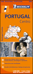
Central Portugal at 1:300,000 in a series of indexed touring maps from Michelin. The map provides a good presentation of the landscape, highlighting scenic routes and national/regional parks, and includes street plans of Lisbon, Lieria, Coimbra, Castelo Branco, Portalegre and Santarem, showing principal sights and facilities, main traffic routes, one way street and pedestrianized areas; each plan has a short index listing main streets. The map also indicates locations with a street plan in the Michelin`s Red Guide to hotels and restaurants in Spain and Portugal and includes a distance/driving times table. Please note: cartography is an enlargement of the publishers’ map of the whole of Portugal at 1:400,000, without additional information but in larger print.Maps in the Michelin’s regional series of Portugal have topography indicated by bold relief shading with spot heights and colouring for forested areas. Detailed road information, characteristic of Michelin’s maps, includes toll and free sections of motorways, road widths, difficult or dangerous roads, restrictions and seasonal closures, steep gradients, level crossings and fords, etc. Railway lines are shown with stations.Tourist information includes pousadas and selected campsites, places of interest, scenic routes and viewpoints, sport and leisure facilities, etc. The maps also indicate locations with a street plan in the Michelin`s Red Guide to hotels and restaurants in Spain and Portugal. The maps have a grid showing latitude and longitude at intervals of 20’. The index of place name is next to the map. Each title also has street plans of main towns, as indicated in the individual descriptions, and a distance/driving time table. Map legend includes English.

Related Products:
 Portugal North Michelin Regional 591
 Portugal South Michelin Regional 593
 Portugal: Michelin Regional Road Maps
 Andalucia Michelin Regional 578
 Galicia Michelin Regional 571
 Aragon – Catalonia Michelin Regional 574
 Asturias – Cantabria Michelin Regional 572
 Balearic Islands Michelin Regional 579
 Castilla y Leon – Madrid Michelin Regional 575
 Comunidad Valenciana – Murcia Michelin Regional 577
 Basque Country – Navarra – La Rioja Michelin Regional 573
 Extremadura – Castilla-la Mancha – Madrid Michelin Regional 576
 Spain: Michelin Regional Road Maps
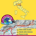
 Italy Central Michelin Regional 563
 Germany Northeast Michelin Regional 542
 Germany North West Michelin Regional 541
 Germany Southwest Michelin Regional 545
 Germany Mideast Michelin Regional 544
 Italy South Michelin Regional 564
 Italy North East Michelin Regional 562
 Germany Southeast – Bavaria Michelin Regional 546
 Italy North West Michelin Regional 561
 Spain – Portugal 2022 Michelin 734
 Northern England – Midlands Michelin Regional 502
 Germany Mid West Michelin Regional 543
 Wales – South West England – Midlands Michelin Regional 503
 Central Portugal Turinta
 Germany: Michelin Regional Road Maps
 Italy: Michelin 200K Regional Road Maps
 Spain – Portugal 2020 Michelin WATERPROOF
 Scotland Michelin Regional 501 WATERPROOF
 Portugal – Madeira Michelin
 Scotland Michelin Regional 501
 Poland: Michelin Regional Road Maps
 Spain & Portugal Michelin Mini-Atlas
 South East England – Midlands – East Anglia Michelin Regional 504
 Poland South West Michelin Regional 557
 Crete Michelin
 Sicily Michelin Local 365
 Sardinia Michelin Local 366