Disclosure : This site contains affiliate links to products. We may receive a commission for purchases made through these links.
Categories
-
Best Sellers
-

Pfeffenhausen
Pfeffenhausen in a series of GPS compatible recreational editions of the Bavarian topographic survey at 1:25,000, with waymarked hiking trails and cycling routes, campsites and youth Read More » -

Sierra de Castril
Sierra de Castril Natural Park in eastern Andalucรญa on a contoured and GPS compatible map at 1:30,000 from Editorial Piolet. Coverage extends from the southern part Read More » -

Gordon`s Great Escape – Southeast Asia
On the second leg of his Great Escapes series, Gordon Ramsay sets out to discover the flavours of Asia, on a remarkable journey that leads him Read More » -
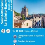
Saint-Maximin-la-Sainte-Baume – Barjols – Trets – Mont Aurelien IGN 3344OT
Topographic survey of France at 1:25,000 in IGN`s excellent TOP25 / Sรฉrie Bleue series. All the maps are GPS compatible, with a 1km UTM grid plus Read More » -

Elementary First Aid, 2000 Edition – IMO Model Course – E-Book
Please allow 1-2 working days for the license to be issued by email. This model course provides training in elementary first aid at the support level Read More » -
Fodor`s Essential Peru: with Machu Picchu & the Inca Trail
For a limited time, receive a free Fodor`s Guide to Safe and Healthy Travel e-book with the purchase of this guidebook! Go to fodors.com for details.Whether Read More » -
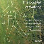
Lost Art of Walking
Walking was once the only way to get around but now we just walk to the bus stop, station or car. Or we walk as a Read More » -
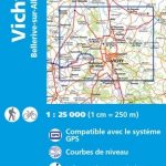
Vichy – Bellerive-sur-Allier IGN Map 2629SB
Topographic survey of France at 1:25,000 in IGN`s excellent TOP25 / Sรฉrie Bleue series. All the maps are GPS compatible, with a 1km UTM grid plus Read More » -

Hautajarvi
The 1:50,000 topographic map gives a more general picture of the ground features than a basic map. It shows settlements, houses, roads, cultivated areas, waterways, cutting Read More » -

Rautjarvi
The 1:50,000 topographic map gives a more general picture of the ground features than a basic map. It shows settlements, houses, roads, cultivated areas, waterways, cutting Read More »
-


