Disclosure : This site contains affiliate links to products. We may receive a commission for purchases made through these links.
Portland


Related Products:
 This Is Portland
 Portland Course Plotter
 Portland Plotter
 Portland Rib Plotter
 Frommer`s Portland Day by Day
 Citix60: Portland
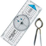
 Portland Protractor 125mm/5″
 Portland Protractor 250mm/10″
 Portland Course Plotter Pack
 111 Places in Portland That You Must Not Miss
 Large Portland Course Plotter
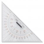 Portland Navigational Triangle 230mm
 Portland Navigational Triangle 200mm
 Insiders` Guide to Portland, Oregon
 C5 Bill of Portland to Salcombe Harbour
 C4 Needles Channel to Bill of Portland
 Admiralty Chart 457 – Portland Bight
 Portland Solid Brass 7″ Straight Divider
 Portland Solid Brass 8″ Straight Divider
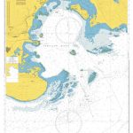
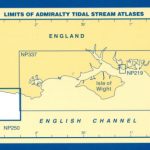 NP257 Tidal Stream Atlas Portland
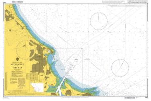
 Admiralty Chart AUS140 – Approaches to Portland
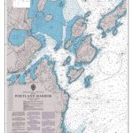 Admiralty Chart 2488 – Portland Harbor
 Admiralty Chart 2268 – Portland Harbour
 Portland Solid Brass 7″ Single Handed Divider
 Portland Solid Brass 8″ Single Handed Divider
 Frommer`s EasyGuide to Seattle, Portland and the Oregon Coast
 Lonely Planet Pocket Portland & the Willamette Valley
 Portland OR Michelin Green Guide Short Stays
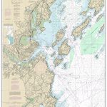 NOAA Chart 13292 – Portland Harbor and Vicinity
 Admiralty Chart 2615 – Bill of Portland to the Needles
 Admiralty Chart 2255 – Approaches to Portland and Weymouth
 Admiralty Chart 2610 – Bill of Portland to Anvil Point
 Admiralty Chart 3315 – Berry Head to Bill of Portland
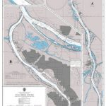
 NOAA Chart 18528 – Willamette River’”Portland to Walnut Eddy
 NOAA Chart 17425 – Portland Canal’”North of Hattie Island
 NOAA Chart 17427 – Portland Canal’”Dixon Entrance to Hattie Island
 Admiralty Chart 2849 – Columbia River Lord Island to Vancouver and Portland
 NOAA Chart 18526 – Port of Portland Including Vancouver – Multnomah Channel (southern part)
 NOAA Chart 17420 – Hecate Strait to Etolin Island including Behm and Portland Canals
 PAC206E Hecate Strait, Dixon Entrance, Portland Inlet and Adjacent Waters and Haida Gwaii, 2015