Disclosure : This site contains affiliate links to products. We may receive a commission for purchases made through these links.
Poplar & Canning Town 1867 – 65.1
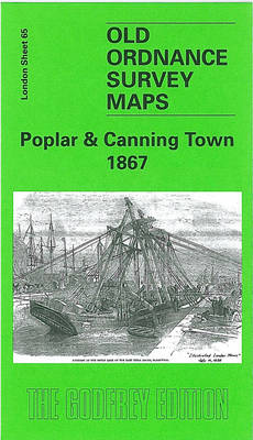
Poplar and Canning Town in 1867 in a fascinating series of reproductions of old Ordnance Survey plans in the Alan Godfrey Editions, ideal for anyone interested in the history of their neighbourhood or family. Three versions cover the area stretching from Upper North Street at Poplar eastward to Rathbone Street at Canning Town, and from Empson Street and Bromley Gasworks southward to Poplar High Street and Blackwall station. The area covers much of Poplar and south Bromley west of the River Lea and part of Canning Town to the east. Features include the East India Dock, Bow Creek, Bromley Marsh, Thames Iron Works, a stretch of the North London Railway with Poplar station, Poplar Gas Works, GER Wharf, Thames Plate Glass Works, Victoria Dock Road, Limehouse Cut, East India Dock Road, West Marsh, tramways, Brunswick Road, a stretch of the GER Woolwich line, with Canning Town station, Poplar Workhouse, Glasshouse Wharf, etc. Each map includes an extract from street directories.About the Alan Godfrey Editions of the 25″ OS Series:Selected towns in Great Britain and Ireland are covered by maps showing the extent of urban development in the last decades of the 19th and early 20th century. The plans have been taken from the Ordnance Survey mapping and reprinted at about 15 inches to one mile (1:4,340). On the reverse most maps have historical notes and many also include extracts from contemporary directories. Most maps cover about one mile (1.6kms) north/south, one and a half miles (2.4kms) across; adjoining sheets can be combined to provide wider coverage.FOR MORE INFORMATION AND A COMPLETE LIST OF ALL AVAILABLE TITLES PLEASE CLICK ON THE SERIES LINK.

Related Products:
 Poplar 1894 – 65.2
 Poplar 1914 – 65.3
 Canning Town & Custom House 1894 – 66.2
 Canning Town & Custom House 1914 – 66.3
 West India Docks 1867 – 79.1
Bow, Bromley & West Ham 1867 – 53.1
West India Docks 1867 – 79.1
Bow, Bromley & West Ham 1867 – 53.1
 Greenwich and the Isle of Dogs 1867
Stratford 1867 – 42.1
Greenwich and the Isle of Dogs 1867
Stratford 1867 – 42.1
 Southampton (East) 1908 – 65.11a
 Central Liverpool 1906 – 106.14b
Central Liverpool 1890 – 106.14a Colour Edition
Central Liverpool 1906 – 106.14b
Central Liverpool 1890 – 106.14a Colour Edition
 Bromley North and Sundridge Park 1895
Middlesbrough North 1913
Chiswick 1867 – 85.1
Bromley North and Sundridge Park 1895
Middlesbrough North 1913
Chiswick 1867 – 85.1
 Kentish Town & Camden 1894 – 38.2
Kentish Town & Camden 1913 – 38.3
Middlesbrough North 1893 (Colour Edition)
West India Docks & Greenwich Marshes 1894 – 79.2
Kentish Town & Camden 1894 – 38.2
Kentish Town & Camden 1913 – 38.3
Middlesbrough North 1893 (Colour Edition)
West India Docks & Greenwich Marshes 1894 – 79.2
 Bromley South 1895
Blackpool North Pier & Town Centre 1910
Leyton 1863-1867
Bromley South 1895
Blackpool North Pier & Town Centre 1910
Leyton 1863-1867
 Leeds South and South East 1906
Leeds South and South East 1890 (Colour Edition)
Redruth 1906
Leeds South and South East 1906
Leeds South and South East 1890 (Colour Edition)
Redruth 1906
 Swansea 1897 – 24.05
Leeds Central and North East 1890
Swansea 1897 – 24.05
Leeds Central and North East 1890
 Bromley Common and North-East Hayes 1895
Dumbarton 1897
East Ham & Barking 1915 – 44.3
Bromley Common and North-East Hayes 1895
Dumbarton 1897
East Ham & Barking 1915 – 44.3
 Hull Alexandra Dock 1908
 Hull North East 1908
 Rotherhithe 1894 – 78.2
 Rotherhithe 1914 – 78.3
South Bank and Grangetown North 1927
Rotherhithe 1914 – 78.3
South Bank and Grangetown North 1927
 Rotherhithe 1868 – 78.1
 Garston 1905 – 113.12b
Trafford Park South 1937
Garston 1905 – 113.12b
Trafford Park South 1937
 Bootle 1907
St Rollox 1894 – 6.07a
Swindon South-East 1899
Bootle 1907
St Rollox 1894 – 6.07a
Swindon South-East 1899