Disclosure : This site contains affiliate links to products. We may receive a commission for purchases made through these links.
Polynesian Islands ITMB Travel Atlas

Polynesian Islands Travel Atlas from ITMB combining into an A5 paperback atlas the publishers’ mapping also available as separate folded maps. For many countries or dependencies the atlas also includes street plans of main towns. Symbols indicate various places of interest, including on street plans also selected hotels and other tourist facilities.Topography is presented by altitude colouring. The maps show local roads and, depending on map scale, selected tracks of hiking trails. Many locations have additional notes on their history, etc. Most panels have latitude and longitude lines. One overall index is at the back of the atlas. The atlas covers: Hawaii (at different scales for individual islands plus several street plans), Nauru (1:50,000), Solomon Islands (1:900,000), Guadalcanal (1:620,000), Western Samoa (1:200,000), American Samoa (various scales), Fiji (1:370,000/550,000), Tonga (various scales), Cook Islands (various scales), Tahiti and the Society Islands (1:100,000), and Easter Island (1:24,000).

Related Products:
 Caribbean Islands Western Half ITMB Travel Atlas
 Caribbean Islands East & South ITMB Travel Atlas
 Middle East ITMB Travel Atlas
 Indian Subcontinent ITMB Travel Atlas
 Cayman Islands & Jamaica ITMB
 Silk Road ITMB Travel Atlas
 Western & Northern Canada ITMB Travel Atlas
 Thailand, Vietnam, Laos & Cambodia ITMB Travel Atlas
 Pan-Americana North ITMB Travel Atlas: Alaska to Panama
 Quebec & Ontario ITMB Travel Atlas
 Hawaii & Honolulu ITMB
 Okinawa & the Ryukyu Islands Periplus Travel Map
 Tahiti & Cook Islands ITMB
 South Pacific Islands Nelles
 Fiji & Tonga ITMB
 Africa Overland – Cairo to Cape Town ITMB Travel Atlas
 Virgin Islands (US and British) ITMB
 Japan Railway & Road ITMB Travel Atlas
 Eastern Canada ITMB Travel Atlas
 South America ITMB Travel Atlas
 Canary Islands ITMB
 Lofoten and Vesteralen Islands
 USA: Nelles Maps of the Hawaiian Islands
 Cape Verde & West Africa ITMB
 Thailand Handy Road Atlas
 Northland: Whangarei, Bay of Islands and 61 Provincial Towns Pathfinder
 Solomon Islands & South Pacific Ocean ITMB
Austria F&B Great Travel Atlas
Solomon Islands & South Pacific Ocean ITMB
Austria F&B Great Travel Atlas
 Latvia Jana Seta Compact Road Atlas
 Balearic Islands Michelin Regional 579
 Galapagos Islands – Quito & Guayaquil ITMB
 Gulf Islands – Nanaimo and Islands ITMB
 Martinique & Guadeloupe ITMB
 British Columbia ITMB Pocket Road Atlas
 Antigua & Dominica ITMB
Providenciales / Provo – Turks & Caicos Islands
Antigua & Dominica ITMB
Providenciales / Provo – Turks & Caicos Islands
 Lithuania Jana Seta Road Atlas HARDBACK
 Bali & Lombok ITMB
 Dominica & Saint Lucia ITMB
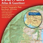 Hawaii Recreational Atlas & Gazetteer