Disclosure : This site contains affiliate links to products. We may receive a commission for purchases made through these links.
Poland/Czech Republic: Hรถfer 200K Road Maps with Historical Place Names
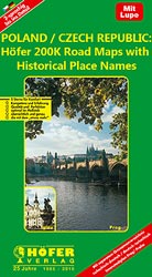
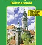
Road maps of areas in Poland and Czech Republic which used to be part of Germany or the Austro-Hungarian Empire, showing both current and the old German place names. In many places former settlements which now no longer exist are also named. Present road and rail networks are supplemented by historical information, e.g. former railway lines. There is no relief detail apart from spot heights. Forests, nature reserves, national park boundaries and locations of interest are marked, and symbols indicate campsites, historical sites, etc. The maps have no geographical coordinates. Map legend includes English.As the maps have dual place names, the print is rather small, but each title comes with a special magnifying lens attached to the map cover. Also included is a booklet with separate, cross-referenced indexes for each set of names and a street plan of the central part of the areaโ€s main city, showing both old and current street layout.


