Disclosure : This site contains affiliate links to products. We may receive a commission for purchases made through these links.
Poland: Carta Blanca/Kompas Road Atlas 2015 GLOVEBOX, SPIRAL-BOUND
Poland Road Atlas, 2014 edition, at 1:500,000 from Carta Blanca/Kompas, with main regions and tourist areas also shown at 1:200,000, transit plans of 21 cities, plus mapping of the whole of Europe for route planning.The atlas, spiral-bound and in a handy glovebox format, covers the whole of the country at 1:500,000, but with its more densely populated regions around main cities or tourist areas such as the Baltic Coast, Mazury Lake District, Tatra Mountains and Bieszczady also shown in greater detail at 1:200,000.Detailed classification of the road network indicates the number of lanes and road surface. Driving distances are shown on main routes (500K) and on many small local roads (200K) and locations of petrol stations are marked. For freight carriers the atlas also shows roads open to heavy traffic. Different types of border crossings are clearly indicated. The atlas also shows railway lines (on 200K mapping with stations and the narrow gauge lines), as well as local airports and ferry routes. Landscape is shown by colouring for woodlands and forested areas, with spot heights for significant hills, peaks and passes, plus names of mountain ranges, lake districts and other geographical features. National parks and regional landscape parks are highlighted. Symbols indicate selected hotels/motels in rural areas, campsites and youth hostels, etc, with the 200K mapping also highlighting various cultural and historical places of interest. The maps have no geographical coordinates. Map legend includes English. The atlas includes transit plans of 21 cities highlighting main through routes and access to the centre. Also provided is an indexed section covering the whole of Europe at 1:4,000,000, ideal for route planning. Other additional information includes a map of the country showing driving distances on main roads and a distance table.

Related Products:
 Finland Road Atlas GLOVEBOX, SPIRAL-BOUND
 Italy F&B Great Road Atlas SPIRAL-BOUND
 Hungary – Budapest Road Atlas SPIRAL-BOUND
Ukraine Road Atlas (500K, Spiral-bound)
Hungary – Budapest Road Atlas SPIRAL-BOUND
Ukraine Road Atlas (500K, Spiral-bound)
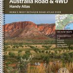
 Australia Hema Road & 4WD Touring Atlas A4 SPIRAL-BOUND
 Australia Hema Road & 4WD Atlas SPIRAL-BOUND
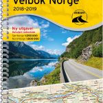
 Norway F&B Supertouring Road Atlas SPIRAL-BOUND
 USA – Southern Canada Marco Polo Road Atlas A4 SPIRAL-BOUND
 Alps – Northern Italy MairDumont Road Atlas SPIRAL-BOUND
 Australia Hema Road & 4WD Easy Read Atlas SPIRAL-BOUND
 Western Australia Hema Road & 4WD Track Atlas A4 SPIRAL-BOUND
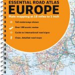
 Europe Collins Essential Road Atlas 2021 A4 SPIRAL-BOUND
 Poland ExpressMap Professional Users Road Atlas 2020/2021
 USA NGS Adventure Edition Road Atlas A3 SPIRAL-BOUND
 USA Hema The Ultimate Road Atlas A3 SPIRAL-BOUND
 Australia UBD Gregory`s Road Atlas A4 SPIRAL-BOUND
 New Zealand Hema Touring Atlas A4 SPIRAL-BOUND
 Hungary Pocket Road Atlas SPIRAL-BOUND
 Australia Hema Handy Atlas SPIRAL-BOUND
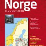
 Norway Road Atlas SPIRAL-BOUND
 Finland Karttakeskus Motorbikers Road Atlas A5 SPIRAL-BOUND
 Benelux – North France Michelin Road Atlas SPIRAL-BOUND
 New Zealand Kiwimaps Compact Travellers Atlas SPIRAL-BOUND
 Norway Cappelens Road Atlas A4 SPIRAL-BOUND
 Australia Hema Motorcycle Atlas Set – 200 Top Rides SPIRAL-BOUND
 Britain & Ireland Philip`s Complete Road Atlas 2017 SPIRAL-BOUND
 Europe AA Road Atlas 2020 FLEXI-BOUND
 Europe Collins Essential Road Atlas A4 SPIRAL-BOUND
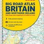 Britain and Northern Ireland Collins Big Road Atlas 2022 A3 SPIRAL-BOUND
 Great Britain A-Z Road Atlas 2022 A4 SPIRAL-BOUND
 Britain & Ireland Philip`s Handy Road Atlas A5 SPIRAL-BOUND
 Great Britain: A-Z Road Atlas 2015 – A4, SPIRAL BOUND SUPERSEDED
 Britain & Ireland Philip`s Road Atlas 2022 A4 SPIRAL-BOUND
 Great Britain A-Z Handy Road Atlas 2022 A5 SPIRAL-BOUND
 Great Britain: A-Z Handy Road Atlas 2015 – A5, SPIRAL BOUND SUPERSEDED
Britain and Northern Ireland Collins Big Road Atlas 2023 A3 SPIRAL-BOUND
USA Rand McNally Road Atlas & National Park Guide 2022 A3 SPIRAL-BOUND
Great Britain: A-Z Handy Road Atlas 2015 – A5, SPIRAL BOUND SUPERSEDED
Britain and Northern Ireland Collins Big Road Atlas 2023 A3 SPIRAL-BOUND
USA Rand McNally Road Atlas & National Park Guide 2022 A3 SPIRAL-BOUND
 France Philip`s Navigator Road Atlas SPIRAL-BOUND
Great Britain & Northern Ireland A-Z Super Scale Road Atlas 2023 A3 SPIRAL-BOUND
France Philip`s Navigator Road Atlas SPIRAL-BOUND
Great Britain & Northern Ireland A-Z Super Scale Road Atlas 2023 A3 SPIRAL-BOUND
 Great Britain & Northern Ireland A-Z Super Scale Road Atlas 2022 A3 SPIRAL-BOUND