Disclosure : This site contains affiliate links to products. We may receive a commission for purchases made through these links.
Pokhara City – Lake Side Valley
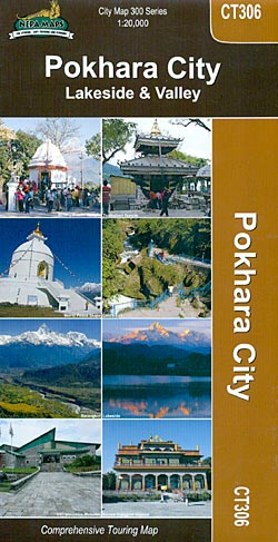
Pokhara on a double-sided map from Nepa Maps combining a very detailed street plan of its tourist Lakeside district, a street plan of the whole town, and a contoured map of the Pokhara Valley, all three indexed and highlighting sights and facilities.One side is divided into two panels. A very detailed plan at 1:4,000 covers the town’s Lakeside area where most of the tourist facilities are located. Streets are annotated with symbols, most with names, showing hotels, restaurants, bars and cafes, banks and ATMs, shops, trekking and other travel agencies, internet cafes, cycle and hike hire, temples and other sights, etc. The whole of Pokhara is shown similarly annotated on the second panel at 1:20,000. Both plans have thematic indexes.On the reverse side Pokhara Valley is presented at 1:50,000 on a map with contours and relief shading to show its topography. Road network indicates petrol stations and shows locations with bus and/or taxi services. Trekking routes are marked, various places of interest are highlighted and villages are annotated with symbols indicating accommodation, etc. The map has latitude and longitude margin ticks at intervals of 2ยฐ30’ and is indexed. Map legends include English.Also provided is a general introduction to the city with a list of main trekking routes around it.

Related Products:
 Pokhara Valley
 Pokhara to Muktinath and Jomosom
 Kathmandu City – Patan – Bhaktapur
 Nepal Nelles
 Tsum Valley Trekking Map
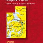
 Salt Lake City UT Rand McNally
 Lake Llanquihue and Surrounding Region
 Sikkim & India Northeast ITMB
 Kullu Valley, Parabati Valley & Central Lahul
 Brisbane Suburbs & City Centre UBD Gregory`s 418
 Ruby Valley Trek
 Lisburn City OSNI Street Plan
 Aconcagua and the Southern Andes: Horcones Valley (Normal) and Vacas Valley (Polish Glacier) ascent routes
 Manaslu & Tsum Valley
 Old City of Jerusalem Map
 Turkish Riviera – Antalya – Side – Alanya Top 10 Tips
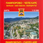 Smolyan – Chepelare – Pamorovo and the Surrounding Area
 Piedmont – Turin – Aosta Valley F&B Top 10 Tips
 Melbourne UBD Gregory`s City Pocket 360
 Tilicho Hidden Lake
 Lake Vyrnwy & Llanfyllin – Tanat Valley OS Explorer Map 239 (paper)
 Lake Vyrnwy & Llanfyllin – Tanat Valley OS Explorer Active Map 239 (waterproof)
 Riga City Center Jana Seta Street Plan
 Fraser Valley and Vancouver ITMB
 Palma de Mallorca City Map / Mallorca Road Map
 Dublin City Centre Tourist Map
 Bergen Cappelen Street Plan
 Wye Valley Walking: 30 Walks Throughout the Valley Between Chepstow to Plynlimon
 Armagh City OSNI Street Plan
 Barcelona “Maps to Go” Street Plan
 Kathmandu Valley
 Yosemite Valley
 Kos Geopsis 212
 Sopron
 Santiago de Compostela
 Vatican F&B City Pocket
 The Kent Ramblers Guide to Three River Valley Walks in West Kent: Darent Valley Path, Eden Valley Walk, Medway Valley Walk
 Toledo
 Bangladesh & India East ITMB