Disclosure : This site contains affiliate links to products. We may receive a commission for purchases made through these links.
Pleven

Street plan of Pleven at 1:8,500, with maps of the Kaylaka Park and the Gorges of the Chernelka River, a road map of the surrounding region, plus a extensive list of various local services such as hotels, banks, shopping, etc.The plan shows bus and trolleybus routes with stops and line numbers and is annotated with symbols highlighting locations various facilities including information centre, hotels, cash dispensers, petrol stations and car repairs, etc. Streets show selected house numbers for easier identification of addresses. Only names of largest streets and some facilities are given in Latin alphabet. All the rest, including the street index is in Cyrillic only. Map legend includes English.Insets show Kaylaka Park at 1:17.000 with roads, tourist accommodation and places of interest, plus a very basic map of the Gorges of the Chernelka River at 1:25,000. Also provided is a road and rail map of the Pleven administrative district and the area south of it (no scale is indicated). Names of larger towns are in both scriptsThe map also includes an extensive gazetteer of various facilities and services within Pleven, including hotels and other accommodation, and notes about the city and its region. All the information is tri-lingual: Bulgarian, English and German.

Related Products:
 Varna
Varna
 Plovdiv
 Smolyan – Chepelare – Pamorovo and the Surrounding Area
 Bansko (with Pirin National Park)
 Sofia Domino Street Plan
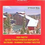
 Bansko (with Ski Routes)
 Ruse
Ruse
 Stara Zagora
 Shumen
 Burgas and the Nearby Black Sea Resorts
 Bishkek Street Plan
 Sofia Street Atlas with Vitosha Massif
 Vitosha – Verila
 Irkutsk
 Skopje Street Atlas
 Samokov – Borovets with the Rila Mountains
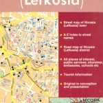 Nicosia
 Doha Street Plan
 Poznan ExpressMap Street Plan
 Limassol Pocket Street Plan
 Bergen Cappelen Street Plan
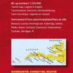 Lofoten and Vesteralen Islands
 Czestochowa ExpressMap Street Plan
 Dushanbe
 Greater Oslo Cappelen Street Plan
 Blue Mountains Suburban Streets UBD Gregory`s 290
 Salzburg F&B Street Plan
 Plymouth A-Z Street Plan Wall Map
 Kielce ExpressMap Street Plan
 Krakรณw – Niepolomice – Skawina – Wieliczka ExpressMap Street Plan
 Moscow Jana Seta Street Plan
 Mumbai (Bombay) Street Atlas
 Leeds A-Z Street Plan Wall Map
 Kiev Kartografija Street Plan
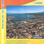 Geneva: Greater Geneva Street Plan
 Brisbane Suburbs & City Centre UBD Gregory`s 418
Lodz ExpressMap Street Plan
Brisbane Suburbs & City Centre UBD Gregory`s 418
Lodz ExpressMap Street Plan
 Taif/At Taif
 Wroclaw ExpressMap Street Plan
 Chalkidiki / Halkidiki – Thessaloniki Street Plan Terrain Editions 412