Disclosure : This site contains affiliate links to products. We may receive a commission for purchases made through these links.
Planning Charts for Pacific Coast of Canada
Canadian Hydrographic Service charts covering large areas of the Pacific coast of Canada, ideal for planning routes.
Related Products:
 Planning Charts for Atlantic Coast of Canada
 Planning Charts for Arctic Coast of Canada
 Pacific Coast Mexican SEMAR charts
 Labrador Coast Charts
 New Brunswick Coast Charts
 NOAA Charts for Alaska Coast (Planning Charts)
 NOAA Charts for Pacific Coast
 West Coast of Vancouver Island and Queen Charlotte Sound Charts
 US Pacific Coast – Charlie`s Charts Cruising Guide
 Charts for Hudson Bay, Baffin Island and Adjacent waters
 Gulf of Mexico and the Caribbean coast Mexican SEMAR charts
 CHS Chart 4506 – Plans in the Vicinity of Canada Bay
 CHS Chart 4538 – Canada Bay including Chimney Bay
 Charts for Haida Gwaii
 Newfoundland Coast including St Pierre and Miquelon
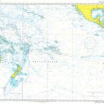
 Admiralty Chart 4002 – A Planning Chart for the Pacific Ocean
 General and Regional Mexican SEMAR charts
 Admiralty Chart 4008 – A Planning Chart for the North Pacific Ocean
 Admiralty Chart 4007 – A Planning Chart for the South Pacific Ocean
 Admiralty Chart 2493 – Ports on the Pacific Coast of Costa Rica and Panama
 Admiralty Chart 3047 – Russia Pacific Coast Ports in Zaliv Pos`yeta
 New Zealand Charts for Pacific Islands
 CHS Chart 4583 – St Julien Island to Hooping Harbour including Canada Bay
 Charts for Juan de Fuca, Johnstone and Georgia Straits
 CHS Chart 4507 – Northeast Coast of Newfoundland
 CHS Chart 4712 – Plans on the Coast of Labrador
 Quebec, St Lawrence River and Anticosti Island Charts
 NOAA Charts for Hawai’ian and Pacific Islands
 NOAA Charts for North Pacific Ocean
 SHOM Routeing Charts for the Pacific Ocean
 The Pacific Crest Trail: Hiking the PCT from Mexico to Canada
 CHS Chart 4505 – Planson the East Coast of the Island of Newfoundland
 CHS Chart 3860 – Harbours on the West Coast of Graham Island
 Admiralty Chart 4016 – A Planning Chart for the Eastern Atlantic Ocean to the Western Pacific Ocean
 Canada Lonely Planet Planning Map
 SHOM Charts for the South West Coast of France – North Coast of Spain
 Admiralty Chart 4610 – Pacific-Antarctic Rise to Southeast Pacific Basin
 Admiralty Chart 4611 – Southwest Pacific Basin to Pacific-Antarctic Rise
 SEMAR Chart 001 – Zona Economica Exclusiva – Mexico Coast and Approaches
 Moon Pacific Northwest Road Trip (Third Edition): Outdoor Adventures and Creative Cities from the Coast to the Mountains


