Disclosure : This site contains affiliate links to products. We may receive a commission for purchases made through these links.
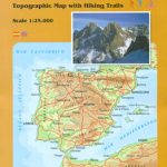
Picos de Europa Western Massif: El Cornion Adrados Map PAPER
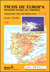
Paper edition of Picos de Europa West: El Cornion Massif, a contoured and GPS compatible map at 1:25,000 from Adrados Ediciones with an exceptionally vivid presentation of the terrain, plus on the reverse a panorama drawing of the area, a list of summits and caves with GPS waypoints, etc.Contours at 10m intervals, enhanced by bold shading and graphic relief, provide an excellent representation of the terrain. The map also has plenty of spot heights and names of peaks or other topographic features. An overprint highlights local hiking routes, indicating difficult sections, ski trails and mountain bike routes, huts and refuges, access points to caves, etc. The map has a 1km UTM grid. Map legend in Spanish and English. On the reverse is a panorama drawing of the area covered by the map, lists of GPS peaks and caves with their GPS waypoints, a list of local refuges indicating capacity and services, etc.To see the list of other hiking maps from Adrados Ediciones, including a waterproof and tear-resistant version of this title, please click on the series link.

Related Products:
 Picos de Europa – Central and East Massifs: Los Urrieles and Andara Adrados Map PAPER
 Picos de Europa – Central and East Massifs: Los Urrieles and Andara Adrados Map WATERPROOF
 Picos de Europa and Eastern Coast of Asturias Adrados Map
 Picos de Europa National Park – Anillo de Picos Adrados Map
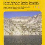 Fuentes Carrionas Massif Adrados Map PAPER
 Picos de Europa National Park Short and Long-Distance Trails
 Sierra de Gredos Adrados Map
 Posets and la Maladeta Massifs Adrados Map
 Spain: Adrados Hiking Maps
Somiedo Natural Park – Babia and North Laciana Adrados Map
Spain: Adrados Hiking Maps
Somiedo Natural Park – Babia and North Laciana Adrados Map
 Cordillera Cantabrica – Asturias and the Surrounding Provinces Adrados Map
 Picos de Europa National Park 2-Map Set Editorial Alpina
 Picos de Europa National Park 3-Map and Guide Set CNIG ENGLISH
 Picos de Europa National Park 3-Map and Guide Set CNIG SPANISH
 Picos de Europa Sunflower Landscape Guide
 Alta Via dei Monti Liguri Western Part: from Passo del Faiallo to Passo dei Giovi 25K Ed. Multigraphic Map No. AVML1
 La Laguna Negra ‘“ Picos de Urbiรณn
 Hegau – Western Lake Constance Kompass 783
 Tatras Western: Koscielisko and the Western Valleys (Tatry Zachodnie)
 รcrins Massif National Park Didier Richard 05
Saxon Switzerland – Western Oberlausitz Kompass 810
รcrins Massif National Park Didier Richard 05
Saxon Switzerland – Western Oberlausitz Kompass 810
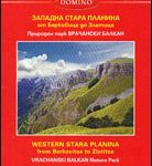 Stara Planina Western: Berkovita to Zlatitsa Domino Map
 Chaรฎne des Puys – Massif du Sancy IGN 75015
 Western Thuringian Forest Nature Park Kompass 812
Western Ore Mountains – Aue – Eibenstock – Kurort Oberwiesenthal Kompass 806
Western Thuringian Forest Nature Park Kompass 812
Western Ore Mountains – Aue – Eibenstock – Kurort Oberwiesenthal Kompass 806
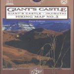 Drakensberg Range 3 – Giant`s Castle – Monk`s Cowl
 South Africa: 50K Hiking Maps of the Drakensberg Mountains
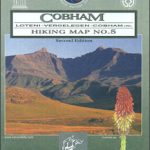 Drakensberg Range 5 – Cobham – Lotheni – Vrgelegen – Cobham
 Drakensberg Range 6 – Garden Castle – Cobham – Bushman`s Nek
 Drakensberg Range 1 – Royal Natal – Rugged Glen – Mweni
 Drakensberg Range 4 – Highmoor – Giant`s Castle – Kamberg – Mkhomazi
 Drakensberg Range 2 – Cathedral Peak – Culfargie – Monk`s Cowl
 South Tyrol – Dolomites Tabacco Road and Panorama Map
 Western Tatras – Polish and Slovak
 Western Australia Hema
 Augsburg Western Forests Kompass 162
 Massif de la Vanoise IGN 75003
 Dolomites ‘“ Lake Garda ‘“ Verona – Venice 200K Tabacco Road & Panorama Map
Toubkal Massif
Dolomites ‘“ Lake Garda ‘“ Verona – Venice 200K Tabacco Road & Panorama Map
Toubkal Massif