Disclosure : This site contains affiliate links to products. We may receive a commission for purchases made through these links.
Philippines Odyssey Map
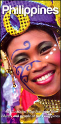
Philippines on a map at 1:1,950,000 from Odyssey Guides presenting the country on one side with descriptions of its natural sites and recreational possibilities and on the reverse with historical and cultural information.On one side is a map with colouring and shading to indicate the topography. The map shows the network of main roads, principal ferry connections and domestic airports. Local administrative boundaries are shown with names of the provinces but fewer smaller towns and villages are marked than on other general road maps of the country. National parks and popular diving sites are highlighted and 26 locations are cross-referenced to descriptions and/or photos which surround the map. Descriptions are also provided several other locations.On the reverse the same map is printed without the colouring, showing fewer locations and just main roads and airports. The surrounding panels and photos, where appropriate cross-referenced to the map, provide information on the country’s history, culture, etc. Also provided is a time-line listing main historical events from the pre-Magellan times to the present day.


