Disclosure : This site contains affiliate links to products. We may receive a commission for purchases made through these links.
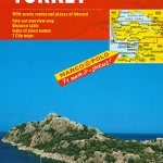
Philippines Marco Polo Map

Philippines at 1:2,000,000 on a clear, indexed map from MairDumont with a street plan of central Manila. A fold-out flap in the jacket makes route planning easier by providing an overview of the whole archipelago with northern Borneo highlighting popular locations, with the grid reference system in the margins making it easier to find places on the main map. A set of seven peel-on/peel-off stickers, removable from the map without damaging its surface, is provided for making special locations more prominent.Topography is indicated by relief shading with spot heights. Roads, airports and, where appropriate, railway lines are shown, and ferry links between the various islands are marked. Also shown are internal administrative boundaries with names of the provinces. Interesting locations, cultural and natural sites and national parks or protected areas are highlighted. Latitude and longitude lines are drawn at intervals of 1ยฐ. Map legend includes English.An index booklet attached to the map cover lists towns or villages, islands, various topographic features such as volcanoes, rives and lakes, etc, as well as places of interest, World Heritage sites and national parks. Also provided is a street plan of central Manila.

Related Products:
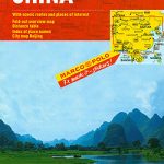 China Marco Polo Map
 Cuba Marco Polo Map
 Greece & the Islands Marco Polo Map
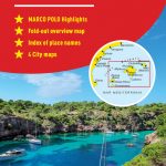 Mallorca – Ibiza – Formentera – Menorca Marco Polo Map
 Kenya Marco Polo Road Map
 USA Marco Polo Map
 Denmark Marco Polo Map
 Languedoc-Roussillon – Auvergne Marco Polo Map
 South Africa – Namibia – Botswana Marco Polo Map
 Northern France Marco Polo Map
 Brittany Marco Polo Map
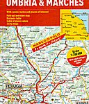 Umbria & Marches Marco Polo Map
 Brazil – Bolivia – Paraguay – Uruguay Marco Polo Map
 Croatia – Slovenia Marco Polo Map
 Corsica Marco Polo Map
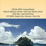 Philippines – Manila Nelles
 Costa Blanca – Valencia – Alicante – Castellon – Murcia Marco Polo Map
 Caribbean Marco Polo Map
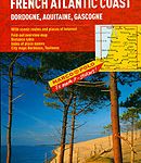 French Atlantic Coast – Dordogne – Aquitaine Gascogne Marco Polo Map
 Canada Marco Polo Map
 Sardinia Marco Polo Map
 Austria – Liechtenstein – South Tyrol Marco Polo Road Atlas
 Algarve – Southern Portugal Marco Polo Map
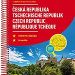 Czech Republic Marco Polo Road Atlas
 Belgium – Netherlands – Luxembourg Marco Polo Road Atlas
 Crete Marco Polo Map
 Bohemia Marco Polo Map
 Slovakia Marco Polo Map
 Italy: MairDumont Marco Polo 200K Regional Road Maps
 Andalucia – Costa del Sol – Seville – Cordoba – Granada Marco Polo Map
 Ireland Marco Polo Map
 Moravia Marco Polo Map
 Tuscany Marco Polo Map
 Turkey Marco Polo Map
 Costa Brava – Andorra – Perpignan – Barcelona Marco Polo Map
 Philippines ITMB
 California Marco Polo Map