Disclosure : This site contains affiliate links to products. We may receive a commission for purchases made through these links.
Philippines – Manila Nelles
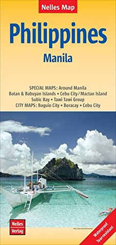
Double-sided Philippines map at 1:1,500,000 offering a convenient format for use when travelling. Includes a large street plan of central Manila.The country is divided north/south with the northern most and the southernmost groups of smaller islands shown on insets. Relief shading with spot heights and names of mountain ranges presents the topography. Road network distinguishes between highways in good and poor condition and shows partially paved roads and cart tracks, with distances on main routes. Railway lines, ferry connections and local airports are included and the map also shows internal administrative boundaries with names of the provinces. Various places of interest are prominently marked. Latitude and longitude margin ticks are at 1ยฐ intervals. The map has no index of localities. Map legend includes English.A large street plan (half of one side of the map) covers the central districts of Manila at 1:17,500. The plan highlights various public buildings, places of interest and selected accommodation. There is no street index. More insets present in greater detail the environs of Manila, Subic Bay, Cebu City with Mactan Island, and Boracay Island, plus street plans of central Cebu City and Baguio City ‘“ all are annotated with places of interest and selected accommodation.


