Disclosure : This site contains affiliate links to products. We may receive a commission for purchases made through these links.
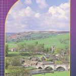
Perthshire: Highland Perthshire Cycling Map

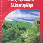
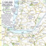
Waterproof folded cycling map of Highland Perthshire at 1:100,000 from Harvey Maps. The cycleway is prominently highlighted with main road sections clearly marked, and distances marked in kilometres. The road network is shown, including minor roads and forest tracks; railway lines and stations are displayed.Topography is shown through use of spot heights, and altitude colouring at 75m intervals. Terrain variations such as woodland and crags are indicated. The map is GPS compatible. Points of interest and local facilities are clearly displayed, including campsites, cycle shops, accommodation, and car parks.To see other titles in this series please click on the series link.

Related Products:
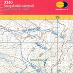
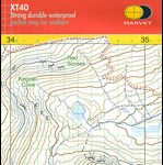
 West Highland Way Harvey National Trail XT40
 Czechia
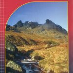
 Walking Ben Lawers, Rannoch and Atholl: Mountains and Glens of Highland Perthshire
 Mt Hymettus Terrain Editions 241
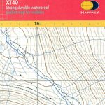
 East Highland Way Harvey National Trail XT40
 Czech Republic 100K Cycling Atlas
 Isle of Man Harvey Superwalker XT30
 Czechia Shocart 75K Cycling Atlas
 Scottish Cycle Routes: 30 Lowland & Highland Road Routes
An Teallach & Fisherfield Harvey Superwalker
Ridgeway Harvey National Trail XT40
Scottish Cycle Routes: 30 Lowland & Highland Road Routes
An Teallach & Fisherfield Harvey Superwalker
Ridgeway Harvey National Trail XT40
 Northumberland Coast Path & Berwickshire Coastal Path Harvey National Trail XT40
 Torridon Harvey Superwalker XT25
 Pembrokeshire Coast Path Harvey National Trail XT40
 Glyndwr`s Way Harvey National Trail XT40
 Scottish Cycle Routes Volume 2: 30 Lowland & Highland Road Routes from the Borders to the Hebrides: 2
 St Cuthbert`s Way Harvey National Trail XT40
 Two Moors Way Harvey National Trail XT40
Cotswold Way Harvey National Trail XT40
Two Moors Way Harvey National Trail XT40
Cotswold Way Harvey National Trail XT40
 Affric Kintail Way Harvey National Trail XT40
 Dales Way Harvey National Trail XT40
 The Cuillin – Skye Harvey Superwalker XT25
 Cumbria Way Harvey National Trail XT40
Cleveland Way Harvey National Trail XT40
Cumbria Way Harvey National Trail XT40
Cleveland Way Harvey National Trail XT40
 Hadrian`s Wall Path Harvey National Trail XT40
 South Downs Way Harvey National Trail XT40
 Ben Venue – Loch Ard Forest & the Trossachs Harvey Superwalker
 Rum – Eigg – Canna – Muck Harvey Superwalker XT25
 Scafell Summit Map
 Arrochar Alps Harvey Superwalker XT25
 Arran – incl. Arran Coastal Way Harvey Superwalker XT25 Map
 North Devon Cycling Map 82
 Ben Nevis Summit Map
 Helvellyn Summit Map
Ben Alder Harvey Superwalker XT25
Helvellyn Summit Map
Ben Alder Harvey Superwalker XT25
 The Great Trossachs Path Harvey National Trail XT40
 Rob Roy Way Harvey National Trail XT40
 Ukraine South