Disclosure : This site contains affiliate links to products. We may receive a commission for purchases made through these links.
Personal Narrative of A Pilgrimage To Al-Madinah and Mecca Vol.1.


Related Products:
 Mumbai to Mecca: A Pilgrimage to the Holy Sites of Islam
 Two Islands Pilgrimage Way = 64 Miles: Early Christianity Pilgrimage Walk from Ramsgate, Isle of Thanet via Minster, Canterbury, Faversham, Sittingbourne to Ninster Abbey on the Isle of Sheppey
 The Great War: A Photographic Narrative
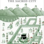 Mecca: The Sacred City
 Romney Romney Marsh Pilgrimage Walk: 25 mile pilgrimage walk
 Narrative of Events in Borneo and Celebes
 Uncommon Dubai +: People, Place, Narrative
 Uncommon: Dubai: People, Place, Narrative
 Times New Romanian: Voices and Narrative from Romania
 The Interesting Narrative of the Life of Olaudah Equiano
 The Unlikely Pilgrimage Of Harold Fry
 The Pilgrimage to Santiago
 Pilgrimage: Journeys of Meaning
 A Steam Engine Pilgrimage
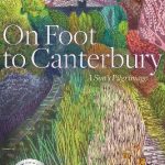 On Foot to Canterbury: A Son`s Pilgrimage
 Still Breathing: 100 Black Voices on Racism–100 Ways to Change the Narrative
 Poacher`s Pilgrimage: An Island Journey
 The Santiago Pilgrimage: Walking the Immortal Way
 Colorless Tsukuru Tazaki and His Years of Pilgrimage
 The Pilgrimage: A Contemporary Quest for Ancient Wisdom
 A Sense of Direction: Pilgrimage for the Restless and the Hopeful
 London to Oxford Pilgrimage Walk St. Frideswides Way
 Pilgrimage: The Great Pilgrim Routes of Britain and Europe
 A Pilgrimage To Eternity: From Canterbury to Rome in Search of a Faith
 Footsteps of Federer: A Fan`s Pilgrimage Across 7 Swiss Cantons in 10 Acts
 The Two Saints Way: A Pilgrimage Route between the Cathedral Cities of Chester and Lichfield
 Pakistan – A Personal History
 Lakeland: A Personal Journey
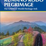 Japan`s Kumano Kodo Pilgrimage: The UNESCO World Heritage trek
 A History of Britain in 21 Women: A Personal Selection
 A History of the World in 21 Women: A Personal Selection
 Nomad – A Personal Journey Through the Clash of Civilizations
 The River Of Lost Footsteps – A Personal History of Burma
 Island of Dreams: A Personal History of a Remarkable Place
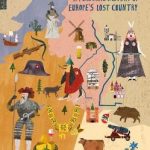 Lotharingia: A Personal History of Europe`s Lost Country
 Lotharingia: A Personal History of France, Germany and the Countries In-Between
 Germania: A Personal History of Germans Ancient and Modern
 Shannon Bennett`s London: A Personal Guide to the City`s Best
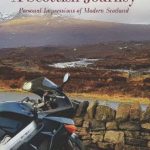 A Scottish Journey: Personal Impressions of Modern Scotland
 Personal Safety & Social Responsibilities, 2016 Edition – IMO Model Course