Disclosure : This site contains affiliate links to products. We may receive a commission for purchases made through these links.
Perivale 1894
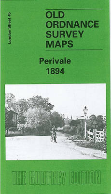
Perivale in 1894 in a fascinating series of reproductions of old Ordnance Survey plans in the Alan Godfrey Editions, ideal for anyone interested in the history of their neighbourhood or family. Two versions of this map have been published; the map covers the northern area of Ealing around Perivale and Pitshanger Lane, stretching from Thames Avenue and Castlebar Park Halt eastward to Mulgrave Road, and from Wadsworth Road southward to Bruton Way. Features then include Pitshanger Park, a short stretch of GWR West Ealing Loop with Castlebar Park Halt, Princess Helena College, University College Hall, St Barnabas church, Perivale church, Hoover factory, Western Avenue, Brentside Farm, athletic grounds, sewage works, Kent Hotel, golf courses, etc. The 1894 version has on the reverse a part of a six inch to the mile map covering a wider area, including Perivale, Greenford Green, Horsendon Hill and a stretch of the Grand Junction Canal.About the Alan Godfrey Editions of the 25″ OS Series:Selected towns in Great Britain and Ireland are covered by maps showing the extent of urban development in the last decades of the 19th and early 20th century. The plans have been taken from the Ordnance Survey mapping and reprinted at about 15 inches to one mile (1:4,340). On the reverse most maps have historical notes and many also include extracts from contemporary directories. Most maps cover about one mile (1.6kms) north/south, one and a half miles (2.4kms) across; adjoining sheets can be combined to provide wider coverage.FOR MORE INFORMATION AND A COMPLETE LIST OF ALL AVAILABLE TITLES PLEASE CLICK ON THE SERIES LINK.

Related Products:
 Ealing 1894
 Greenford 1894
 Hornsey 1894 – 12.2
 South Ealing 1934 – 70.4
 Wood Green 1894 – 7.2
 West Streatham & Tooting 1894 – 135a
Teddington & Hampton Hill 1894 – 131.2
West Streatham & Tooting 1894 – 135a
Teddington & Hampton Hill 1894 – 131.2
 Clapham Park & Balham 1894 – 125.2
 Brixton & Herne Hill 1894 – 116.2
 East Acton & Wormwood Scrubs 1894 – 58.2
North Finchley 1894
East Acton & Wormwood Scrubs 1894 – 58.2
North Finchley 1894
 Alexandra Park & South Friern 1894 – 6a
 Central Newcastle 1894 – 11a
 Tottenham (North) 1894 – 8a
 Eltham Green 1894 – 120.2
 Chelsea & West Brompton 1894 – 87.2
 Highgate 1894 – 19.2
Clapham Common 1894 – 115.2
Highgate 1894 – 19.2
Clapham Common 1894 – 115.2
 Euston & Regent`s Park 1894 – 49.2
 Dulwich Village 1894
 Twickenham & Petersham 1894 – 122
 Streatham Hill & Tulse Hill 1894 – 126.2
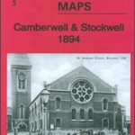 Camberwell & Stockwell 1894 – 102.2
 Beckenham South 1894
 Upper Edmonton 1894 – 3a
 Ilford 1894
Thornton Heath and Norbury 1894
Partick 1894 – 6.05
Ilford 1894
Thornton Heath and Norbury 1894
Partick 1894 – 6.05
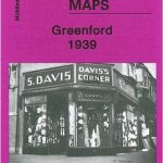 Greenford 1939
 Shortlands 1894
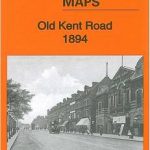 Old Kent Road 1894 – 90.2
 The West End 1894 – 61.2
St Rollox 1894 – 6.07a
Stoke Newington 1894 – 30.2
The West End 1894 – 61.2
St Rollox 1894 – 6.07a
Stoke Newington 1894 – 30.2
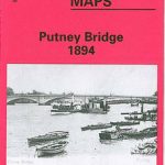 Putney Bridge 1894 – 99.2
North Shields and Chirton 1894
Putney Bridge 1894 – 99.2
North Shields and Chirton 1894
 Holland Park & Shepherds Bush 1894 – 73.2
 Ealing 1934
 Upper Sydenham 1894 – 137.2
Battersea & Clapham 1894 – 101.2
Upper Sydenham 1894 – 137.2
Battersea & Clapham 1894 – 101.2