Disclosure : This site contains affiliate links to products. We may receive a commission for purchases made through these links.
Pennine Way: Edale to Kirk Yetholm
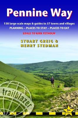
Britain`s best-known National Trail winds for 256 miles through three National Parks – the Peak District, Yorkshire Dales and Northumberland. This is the 5th edition. This superb footpath showcases Britain`s finest upland scenery, while touching the literary landscape of the Bronte family and Roman history along Hadrian`s Wall. *138 large-scale walking maps – at just under 1:20,000 – showing route times, gradients, where to stay, interesting features.*Guides to 57 towns and villages – along the way*Itineraries for all walkers – whether walking the route in its entirety or sampling the highlights on day walks and short breaks.*Practical information for all budgets – Edale to Kirk Yetholm: where to stay with reviews (B&Bs, hostels, campsites, pubs and hotels), where to eat with reviews, what to see, plus detailed town plans*Public transport information – all access points on the path.*GPS waypoints. These are also downloadable from the Trailblazer website.*Now includes extra colour sections: 16pp colour introduction and 16pp of colour mapping for stage sections (one stage per page) with trail profiles.

Related Products:
 The Pennine Way: From Edale to Kirk Yetholm
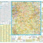
 Pennine Way National Trail
 Offa`s Dyke Path: Prestatyn To Chepstow
 Hadrian`s Wall Path
 Cornwall Coast Path – Bude to Plymouth (South West Coast Path Part 2)
 Pennine Way Cicerone Map Booklet
 Pennine Way South Adventure Atlas: Edale – Bowes SUPERCEDED
 Pennine Way North Harvey XT40 National Trail Map
 West Highland Way: Glasgow to Fort William
 Thames Path: Thames Head to the Thames Barrier (London)
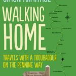 Walking Home, Travels with a Troubadour on the Pennine Way
 Pembrokeshire Coast Path, Trailblazer 6
 Pennine Way North A-Z Adventure Atlas
 Exmoor & North Devon Coast Path, South-West-Coast Path Part 1: Minehead to Bude (Trailblazer British Walking Guide): Practical walking guide with 55 large-scale walking maps (1:20,000) and guides to 30 towns and villages – planning, places to stay, places
 Edale Skyline Challenge Map
 Pennine Way South Harvey XT40 National Trail Map
 Dorset and South Devon Coast Path – Plymouth to Poole (South West Coast Path Part 3)
 South Downs Way (Trailblazer British Walking Guides): Practical guide with 60 Large-Scale Walking Maps (1:20,000) & Guides to 49 Towns & Villages – Planning, Places To Stay, Places to Eat: 2022
 Pennine Bridleway A-Z National Trail Road Map
 Cleveland Way: North York Moors – Helmsley to Filey
 Tour du Mont Blanc: including Chamonix, Courmayeur and Argentiere
 Exmoor & North Devon Coast Path – Minehead to Bude (South West Coast Path Part 1)
 North Downs Way: Farnham to Dover via Canterbury
 National Trails of England, Scotland & Wales – 2nd ed.
 Great Glen Way (Trailblazer British Walking Guide): 38 Large-Scale Maps & Guides to 18 Towns and Villages – Planning, Places to Stay, Places to Eat – Fort William to Inverness
 Pennine Bridleway South Harvey XT40 National Trail Map
 Coast to Coast Path (Trailblazer British Walking Guide): 109 Large-Scale Walking Maps & Guides to 33 Towns & Villages – Planning, Places to Stay, Places to Eat – St Bees to Robin Hood`s Bay
 Cotswold Way: Chipping Campden to Bath
 Trekking the Giants` Trail: Alta Via 1 Through the Italian Pennine Alps: Beneath Mont Blanc, the Matterhorn and Monte Rosa
 Pennine Way South A-Z Adventure Atlas
 Merseyside & Manchester – Pennine Cycleway – The Trans Pennine Trail Sustrans Cycle Map 25
 Pennine Bridleway Harvey XT40 National Trail Map
 South Downs Way: Winchester to Eastbourne
 Offa`s Dyke Path National Trail
 Norfolk Coast Path & Peddars Way
 Pennine Bridleway: From Derbyshire through the Yorkshire Dales to Cumbria
 Great Britain: National Trails and Other Long Distance Paths
 North Downs Way: National Trail Guide
 Walking the Cotswold Way
 Langtang & Helambu ‘“ Trekking Map and Complete Guide