Disclosure : This site contains affiliate links to products. We may receive a commission for purchases made through these links.
Peckham 1871 – 103.1
Peckham in 1871 in a fascinating series of reproductions of old Ordnance Survey plans in the Alan Godfrey Editions, ideal for anyone interested in the history of their neighbourhood or family. Three versions for this area have been published, stretching from Denmark Hill station eastward to Queen`s Road station and Asylum Road; and from Rosemary Road southward to Nunhead Green. Peckham Road and High Street runs west-east across the map with a tramway; Peckham Rye station is in the lower centre of the map. Other features include Peckham House lunatic asylum, Camberwell Workhouse, Brunswick Square, Eagle Mill, Rye Lane, St Giles Church, Brunswick Square, Camberwell Town Hall, Surrey Canal with Peckham Wharf, north end of Peckham Rye Common. The following Wards are named on the map: Town Hall, St Giles, Lyndhurst, Goldsmith, Rye Lane, St Mary`s and Nunhead Wards (though some extend onto adjacent maps). The map is largely part of Camberwell Borough. On the reverse are street directory extracts for (1871 map) Brunswick Square, Church Street, Camberwell Grove, Grove Lane, Southampton St etc; and (1894 map) Camberwell Grove, Grove Lane, High Street, Hill Street, Rye Lane. About the Alan Godfrey Editions of the 25″ OS Series:Selected towns in Great Britain and Ireland are covered by maps showing the extent of urban development in the last decades of the 19th and early 20th century. The plans have been taken from the Ordnance Survey mapping and reprinted at about 15 inches to one mile (1:4,340). On the reverse most maps have historical notes and many also include extracts from contemporary directories. Most maps cover about one mile (1.6kms) north/south, one and a half miles (2.4kms) across; adjoining sheets can be combined to provide wider coverage.FOR MORE INFORMATION AND A COMPLETE LIST OF ALL AVAILABLE TITLES PLEASE CLICK ON THE SERIES LINK.

Related Products:
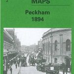 Peckham 1894 – 103.2
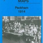 Peckham 1914 – 103.3
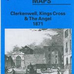 Clerkenwell, King`s Cross & The Angel 1871 – 50.1
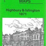 Highbury & Islington 1871 – 39.1
 Kennington & Walworth 1871 – 89.1
 Notting Hill 1871 – 59.1
 East Dulwich & Peckham Rye 1914 – 117.3
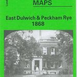 East Dulwich & Peckham Rye 1868 – 117.1
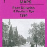 East Dulwich & Peckham Rye 1894 – 117.2
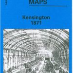 Kensington 1871 – 74.1
Old St Pancras 1871-1894
Charing Cross 1871-1894
Kensington 1871 – 74.1
Old St Pancras 1871-1894
Charing Cross 1871-1894
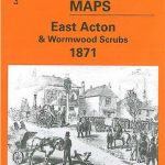 East Acton & Wormwood Scrubs 1871 – 58.1
Camberwell & Stockwell 1913 – 102.3
East Acton & Wormwood Scrubs 1871 – 58.1
Camberwell & Stockwell 1913 – 102.3
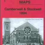 Camberwell & Stockwell 1894 – 102.2
 Crystal Palace 1871 – 7.10
New Cross & Deptford Bridge 1871 – 104.1
Hammersmith & Fulham 1871 – 86.1
Crystal Palace 1871 – 7.10
New Cross & Deptford Bridge 1871 – 104.1
Hammersmith & Fulham 1871 – 86.1
 Holland Park & Shepherds Bush 1871 – 73.1
 Rose Grove and Habergham 1909
 Wavertree and Broad Green 1905
Swiss Cottage 1866-71 – 37.1
Wavertree and Broad Green 1905
Swiss Cottage 1866-71 – 37.1
 Lewisham 1914 – 119.3
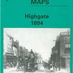 Highgate 1894 – 19.2
 Highgate 1936 – 19.4
 Highgate 1913 – 19.3
 Leytonstone & Leyton 1915 – 23.3
Tooting 1913 – 134.3
Leytonstone & Leyton 1915 – 23.3
Tooting 1913 – 134.3
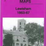 Lewisham 1863-67 – 119.1
Stratford 1867 – 42.1
Lewisham 1863-67 – 119.1
Stratford 1867 – 42.1
 Stratford 1914 – 42.3
 Clerkenwell, King`s Cross & The Angel 1894 – 50.2
Glasgow High Street 1909
Glasgow High Street 1933
Clerkenwell, King`s Cross & The Angel 1894 – 50.2
Glasgow High Street 1909
Glasgow High Street 1933
 Swansea 1897 – 24.05
Penrith 1923
Brightlingsea 1895
Swiss Cottage & South Hampstead 1937 – 37.4
Swansea 1897 – 24.05
Penrith 1923
Brightlingsea 1895
Swiss Cottage & South Hampstead 1937 – 37.4
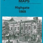 Highgate 1869 – 19.1
Wanstead 1915 – 24.3
Highgate 1869 – 19.1
Wanstead 1915 – 24.3