Disclosure : This site contains affiliate links to products. We may receive a commission for purchases made through these links.
Paxos – Antipaxos Anavasi 9.2
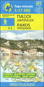
Paxos and Antipaxos at 1:17,000 with recommendations for 12 hiking trails on a detailed, contoured and GPS compatible map from Anavasi, printed on light, waterproof and tear-resistant synthetic paper. The islands’ topography is shown by contours at 20m intervals, with relief shading and altitude colouring. Road network indicates unsurfaced roads and shows country tracks. Distances are marked on all roads and footpaths indicate well defined or faint paths. Symbols highlight various places of interest and facilities. The map has a 1km UTM grid plus latitude and longitude crosshairs at 1’. Map legend includes English.On the reverse Paros is shown on a simplified map with just relief shading to show its road network more clearly and to highlight nine hiking trails recommended by the publishers.To see which other islands are covered by maps from Anavasi, please click on the series link.

Related Products:
 Karpathos – Saria Anavasi 10.50
 Cephalonia / Kefalonia – Ithaca Anavasi 9.3
 Milos – Kimolos – Polyvos Anavasi 10.45
 Kythnos Anavasi 10.44
 Skyros Anavasi 10.14
 Kalymnos – Telendos & Pserimos Anavasi 10.32
 Tinos Anavasi 10.20
 Sikinos Anavasi 10.29
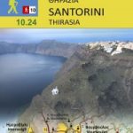 Santorini – Thirasia Anavasi 10.24
 Kea / Tzia Anavasi 10.41
 Serifos Anavasi 10.25
 Andros Anavasi 10.21
 Chios – Psara – Inouses Anavasi 10.31
 Rhodes & Symi Anavasi 10.38
 Chalki Anavasi 10.33
 Hydra Anavasi 10.40
 Greece: Anavasi Hiking Maps of the Mainland and Peloponnese
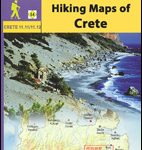 Greece: Anavasi Hiking Maps of Crete
 Zakros – Vai – Sitia Anavasi 11.16
 Spetses Anavasi 10.30
 Monemvasia – Maleas – Elafonisos Anavasi 8.9
 Anafi Anavasi 10.47
 Mainalo – Artemisio – Lyrkeio – Farmakas – Ktenias Anavasi 8.5
 Paros – Antiparos Anavasi 10.23
 Corfu – Othoni – Erikouse – Mathraki Anavasi 9.4
 Naxos & Small Cyclades Anavasi 10.28
 Amorgos Anavasi 10.27
 Mani Anavasi 8.4
 Lefkada Anavasi 9.1
 Alonisos – Northern Sporades Marine Park Anavasi 9.2
 Mt Olympus Anavasi 6.11
 Greece: Anavasi Maps of Greek Islands
Mt Parnitha Anavasi 1.1
Greece: Anavasi Maps of Greek Islands
Mt Parnitha Anavasi 1.1
 Sifnos Anavasi 10.26
 Taygetos – North Taygetos Anavasi 8.1
Mt Elikon Anavasi 2.6
Taygetos – North Taygetos Anavasi 8.1
Mt Elikon Anavasi 2.6
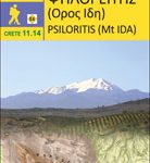 Psiloritis – Mt Ida Anavasi 11.14
 Cyclades – Argosaronic Anavasi Regional Map R1
 Exo Mani – Verga – Kardamyli – Trachila Anavasi 8.10