Disclosure : This site contains affiliate links to products. We may receive a commission for purchases made through these links.
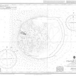
Patagonia & Tierra del Fuego ITMB

Patagonia and Tierra del Fuego on a double-sided map from ITMB showing the mainland on both sides of the Chile ‘“ Argentina border at 1:2,200,000 with Tierra del Fuego and the islands around the Magellan Straights in greater detail at 1:750,000. Both sides show the topography by altitude colouring with plenty of names of mountain ranges, islands, straights and bays, etc.On one side is an indexed map at 1:2,200,000 covering South America southwards from Concepciรณn and Chillรกn in Chile and from north of Bahรญa Blanca in Argentina. Topography is presented by altitude colouring, with graphics indicating national parks and other protected areas. The map shows the regions’ road network, including selected tracks and seasonal roads, as well locations accessible by air services and shipping routes from Puetro Montt along the Chilean fjords. Numerous places of interest are marked, some annotated with brief notes. The map has latitude and longitude lines at 3ยฐ intervals.On the reverse southernmost part of the continent, south of Puerto Natales and Rio Gallegos, is shown in greater detail at 1:750,000. The map indicates border crossings between the two countries, presents the road network with locations of fuel supplies, and shows local airports/airfields and ferry connections. Symbols indicate locations with tourist accommodation, shelters and campsites, beaches, and other places of interest. The map is indexed and has latitude and longitude lines at 30’ and 1ยฐ irrespectively. Also included here is street plan of central Ushuaia indicating locations of hotels and other tourist facilities.

Related Products:
 Argentina South & Tierra del Fuego ITMB
 Southern Patagonia – Tierra del Fuego
 Tierra del Fuego – Antarctica
 Chile South & Patagonia ITMB
 Tierra del Fuego – Cordillera Darwin – Lago Fagnano – Isla Navarino SIG Patagon
 Tierra del Fuego and Isla Navarino
 Patagonia And Tierra Del Fuego Nautical Guide – 3rd Edition
 Antarctica – Tierra del Fuego ITMB
 Tierra del Fuego de Dios Map-Guide SPANISH
 Bhutan & Northeast India ITMB
 South America ITMB
 Paraguay – Bolivia South ITMB
 Santiago & Chile North ITMB
 Kamchatka & Eastern Siberia ITMB
 Albania ITMB
 Portugal & South of Spain ITMB
 Iran & Tehran ITMB
 Bangladesh & India East ITMB
 Barcelona & Catalonia ITMB
 South America Southern ITMB
Zambia & Eastern Africa ITMB Road Map
South America Southern ITMB
Zambia & Eastern Africa ITMB Road Map
 Cape Verde & West Africa ITMB
 Algeria ITMB
 England South & Wales ITMB
 US / Mexico Border ITMB
 Pakistan ITMB
 Florida & US Deep South ITMB
 Tierra del Fuego Historical Maps
 Togo & Benin ITMB
 Quito & Central Ecuador ITMB
Tierra del Fuego – Sector Argentino
Quito & Central Ecuador ITMB
Tierra del Fuego – Sector Argentino
 Arizona & New Mexico ITMB
 Hanoi – Vietnam North ITMB
 Mexico ITMB
 Tanzania ITMB
 Madagascar ITMB
 Mongolia ITMB
 South America North ITMB
 Grand Canyon & Arizona ITMB
 Cayman Islands & Jamaica ITMB