Disclosure : This site contains affiliate links to products. We may receive a commission for purchases made through these links.
Paris & Surrounding Areas Michelin Regional 514
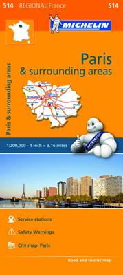
French administrative region of Ille-de-France covering Paris and the surrounding area at 1:200,000 in a series of touring maps from Michelin. The map includes a plan of the capital showing principal traffic arteries across the city and access from the Boulevard Pรจriphรฉrique, plus detailed maps with road access to and the lay-out of the terminals at the Charles de Gaulle and Orly Airports.Maps in the Michelin’s REGIONAL series are designed to cover a large area in each title and offer a more convenient touring alternative to the publishers’ LOCAL coverage of France at 1:150,000. The maps present the road network in great detail, indicating width and the number of lanes, motorway services and rest areas, dangerous or restricted entry roads, steep gradients, height and weight restrictions, etc. Scenic sections are highlighted. The maps also show selected cycle paths and nature trails. Railway lines are shown with stations and local airports are marked. Satellite-derived base with colouring for the forested areas and boundaries of national or regional parks shows the topography. In the mountainous regions the maps have bold, very effective relief shading, with a large number of names of peaks, passes, and other topographic features. The maps have latitude and longitude lines at 10’ intervals and are indexed. Map legend includes English.To see the list of all the regional titles in this series please click on the series link.

Related Products:
 Central France Michelin Regional 518
 Brittany Michelin Regional 512
 Champagne-Ardenne Michelin Regional 515
 Auvergne – Limousin Michelin Regional 522
 Loire Valley Michelin Regional 517
 Burgundy Michelin Regional 519
 Franche-Comte Michelin Regional 520
 Normandy Michelin Regional 513
 Alsace – Lorraine Michelin Regional 516
 Poitou-Charentes Michelin Regional 521
 Languedoc-Roussillon Michelin Regional 526
 Nord-Pas-de-Calais – Picardy Michelin Regional 511
 Aquitaine Michelin Regional 524
 Midi-Pyrรฉnรฉes Michelin Regional 525
 Provence-Alps – French Riviera Michelin Regional 527
 Rhรดne-Alpes Michelin Regional 523
 France: Michelin 200K Regional Road Maps
 Poland: Michelin Regional Road Maps
 Poland South West Michelin Regional 557
 Italy North West Michelin Regional 561
 Italy Central Michelin Regional 563
 Italy South Michelin Regional 564
 Italy North East Michelin Regional 562
 Eure-et-Loir – Paris – Yvelines Michelin Local 311
 Essonne – Paris – Seine-et-Marne Michelin Local 312
 Galicia Michelin Regional 571
 Balearic Islands Michelin Regional 579
 Andalucia Michelin Regional 578
 Portugal Central Michelin Regional 592
 Castilla y Leon – Madrid Michelin Regional 575
 Comunidad Valenciana – Murcia Michelin Regional 577
 Aragon – Catalonia Michelin Regional 574
 Portugal North Michelin Regional 591
 Asturias – Cantabria Michelin Regional 572
 Basque Country – Navarra – La Rioja Michelin Regional 573
 Portugal South Michelin Regional 593
 Spain: Michelin Regional Road Maps
 Extremadura – Castilla-la Mancha – Madrid Michelin Regional 576
 Portugal: Michelin Regional Road Maps
 Italy: Michelin 400K Touring Maps