Disclosure : This site contains affiliate links to products. We may receive a commission for purchases made through these links.
Paragliding Annapurna

Paragliding Annapurna from Napa Maps is a detailed map of the paragliding area north-west of Pokhara, plus separate insets showing five paragliding routes annotated with signs showing thermals, turbulence, etc, as well as places of interest and tourist facilities.An indexed, topographic map at 1:50,000 shows the area north-west of Pokhara, highlighting places of interest, tourist accommodation, bus routes, etc. Five separate insets, all with similar topographic cartography, highlight the flight paths indicating the required height above launch before gilding, big and small thermals, areas of turbulence, bird encounters and cloud base. The routes covered are:* Sarangkot Naudanda Cross-over at 1:40,000* Sarangkot Drop at 1:25,000* Korchon Curcuit at 1:80,000* The Green Wall at 1:50,000* The Griffon’s Challenge: Dickie Danda to Besi Sahar at 1:75,000Also provided is addition flying information and climate data. All the text is in English.

Related Products:
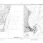
 Bergueda: Berga – Serra del Cadรญ Ed. Alpina Paragliding Map
 Annapurna Base Camp
 Mustang to Annapurna
 North Annapurna Base Camp
 Annapurna: 14 Classic Treks Including Annapurna Circuit
 Around Annapurna (100K)
 Around Annapurna (125K)
 Pokhara City – Lake Side Valley
 Pokhara Valley
 Biking Around Annapurna
 Annapurna NGS Adventure Map 3003
 Annapurna
 North West Highlands
 Annapurna Himal
 Tatopani Trek
 Pokhara to Muktinath and Jomosom
 Annapurna Trekking Atlas
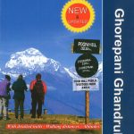 Ghorepani – Ghandruk
 New Zealand F&B
 Japan North & Hokkaido ITMB
 Auckland & North Island ITMB
 Barcelona Borch
 Limpopo & North West Map Studio Pocket Map
 Annapurna Trekking Guide
 Royal Trek
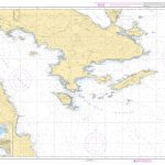
 Greece & the Islands Marco Polo Map
 Annapurna, Naar & Phu Great Himalaya Trail Map
 Surrey, East & West Sussex A-Z Visitors` Map
 South-Holland North – Green Heart West and Bollenstreek Falkplan Cycling Map 14
 Hardangervidda
 Iceland North-West IDNU 1
Brabant West and Central Cycling Map
Iceland North-West IDNU 1
Brabant West and Central Cycling Map
 Brazil Borch
 North Argentina de Dios Regional Map
 USA North-East
 Bolivia ITMB
 Vilnius North West and Its Environs
 Tilicho Hidden Lake
 New Zealand ITMB
Crimea South
New Zealand ITMB
Crimea South