Disclosure : This site contains affiliate links to products. We may receive a commission for purchases made through these links.
Categories
-
Best Sellers
-
Saint-Hubert NGI Topo 59
Topographical survey of Belgium at 1:50,000 from the country’s national survey organization, Nationaal Geografisch Instituut / Institut Gรฉographique National. Contour interval varies according to the terrain, Read More » -

NOAA Chart 11360 – Cape St. George to Mississippi Passes
NOAA maintains the nautical charts and publications for U.S. coasts and the Great Lakes. Over a thousand charts cover 95,000 miles of shoreline and 3.4 million Read More » -

LETTER Z Code Signal ( Shore Stations ) Flag – 15 x 12 inch – printed
We are able to source a wide range flags in many sizes, sewn or printed on 100% Ministry Of Defence Standard Woven and Knitted Polyester. Flags Read More » -

Submarine
`Are we making a bomb?` `This is a trust exercise, like in drama,` she says. `Are we making a bomb as a trust exercise?`Fifteen-year-old Oliver Tate Read More » -
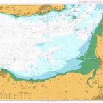
Admiralty Chart 1152 – Bristol Channel Nash Point to Sand Point
Admiralty standard nautical charts comply with Safety of Life at Sea (SOLAS) regulations and are ideal for professional, commercial and recreational use. Charts within the series Read More » -
NZ614 Tasman Bay / Te Tai-o-Aorere
Plans included:Port Motueka 1:20,000Mapua 1:20,000Nautical charts for New Zealand, created by Land Information New Zealand (LINZ), are printed on demand at Stanfords after your order is Read More » -

Rome Michelin Citymap
Rome at 1:12,500 on a ‘write & wipe” waterproof and tear-resistant, indexed street plan from Michelin with an enlargement of the Piazza Navona area, a road Read More » -

Turtles All the Way Down
`Our hearts were broken in the same places. That`s something like love, but maybe not quite the thing itself`Aza`s life is filled with complications. Living with Read More » -

Lons-le-Saunier – Poligny – Reculee de Baume IGN 3226ET
Topographic survey of France at 1:25,000 in IGN`s excellent TOP25 / Sรฉrie Bleue series. All the maps are GPS compatible, with a 1km UTM grid plus Read More » -

The Rise and Fall of the Arab Empire
The rise and fall of the Arab Empire Read More »
-


